Utah State Map
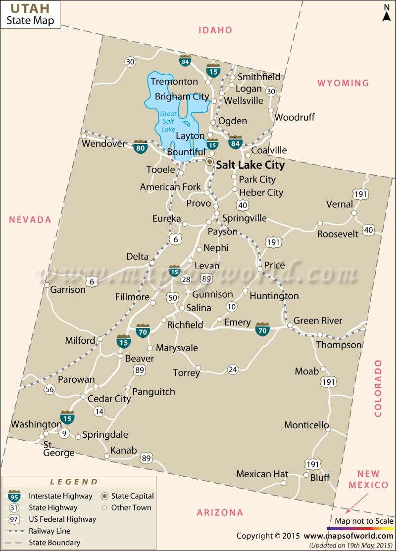
The Utah state map indicates the location of various counties, cities, national and interstate highways, capital city and railway lines of the state.
Being placed on the western corner of United States of America, Utah lies within the geographical premises of Rocky Mountains. Towns like Kanab, Emery, Beaver, Moab, Woodruff, Thompson, St. George, Milford, Bluff, Garrison, Monticello and several others are prominently illustrated in the map of Utah. Also, the capital of the state, Salt Lake City, is highlighted in the Utah Map.
Interstate 84, Interstate 15, Interstate 80 and Interstate 70 of the state are also marked in the map of Utah. While Interstate 84, Interstate 80 and Interstate 70 link the east-west parts of Utah, Interstate 15 connects the north-south destinations of the state. Green river and Colorado River are the main waterways of Utah, both of which are pointed out in the Utah state map. The networks of railways through which various towns of the state are efficiently connected to each other are also highlighted in Utah map. Colorado, Nevada, Wyoming, Idaho and Arizona, bordering the state, are clearly shown in the map of Utah. The Utah state map is an informative indicator which offers information about the place.
 Wall Maps
