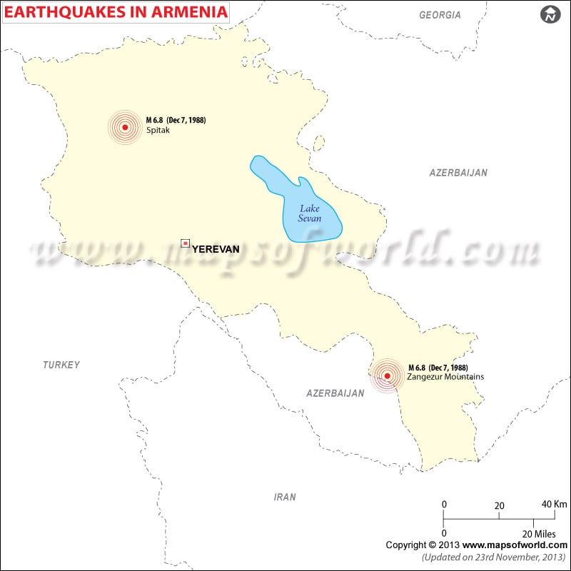
Armenia Earthquake took place on December 7, 1988, at 11:41 am. local time. The magnitude of the earthquake which shook northwestern Armenia was 6.9 and this was followed by another earthquake four minutes later, measuring 5.8 on Richter scale.
Swarms of aftershocks of the Earthquake of 1988 in Armenia having a magnitude of 5.0, continued for months in the area around Spitak. Spitak was completely destroyed, which had a population of about two lakh fifty thousand.
Armenia Earthquakes hit an area of approx 80 km that included the towns of Leninakan, Spitak, Stepanavan, and Kirovakan in the Armenian Soviet Socialist Republic. The epicenter of Armenia Earthquake was located in the Lesser Caucasus highlands, an area which has experienced damaging earthquakes in the past. Other damaging earthquakes of 1899 and 1940 occurred within 100 km of the 1988 epicenter.
Armenia Earthquake recorded largest death and property damages since the earthquake of 1976 of Tangshan, China that killed more than 240,000 people. 45,000 people were killed, fifteen thousand were injured and 517,000 people became homeless in 1988 Earthquake of Armenia. United Nations official exchange recorded a direct economic losses of $14.2 billion (U.S.).
Armenia Earthquake was one of the massive natural disaster of that time. The 1988 Earthquake of Armenia struck at the moment when people was completely unprepared for it and was in their most vulnerable state.

 Population of Armenia