- Neighboring Countries - Italy
- Continent And Regions - Europe Map
- Other San Marino Maps - San Marino Map, Where is San Marino, San Marino Blank Map, San Marino Road Map, San Marino River Map, San Marino Cities Map, San Marino Flag
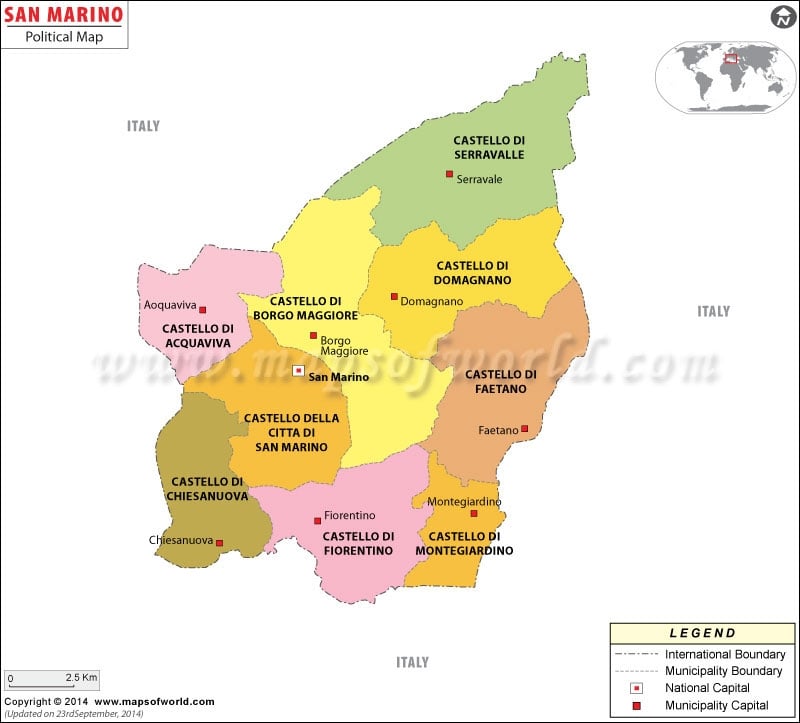
San Marino Political Map locates the various provinces into which San Marino is divided. It is situated in central Italy with its capital city by the same name. San Marino happens to be the third smallest European state.
San Marino Geography
San Marino is a landlocked country that is located in central Italy on the geographical coordinates of 43°46′ North latitude and 12°25′ East longitude. The total are covered by San Marino is 61.2 sq km. Monte Titano is the highest point and Torrente Ausa is the lowest point of San Marino. It is also the third smallest state of Europe.
The capital city of San Marino is also by the same name. It is located on the latitude of 43°56′ North and longitude of 12°25′ East.
San Marino Provinces
San Marino Political Map shows the important provinces of San Marino.
These important provinces include:
- Castello di Serravalle
- Castello di Domagnano
- Castello di Featano
- Castello diMontegiardino
- Castello di Fiorentino
- Castello di Chinesanouva
- Castello di Acquaviva
- Castello di Borgo Maggiore
- Castello della Citta di San Marino
The national and the international boundary are distinctly shown on the printable Political Map of San Marino with black dotted uneven lines.
A square box at the extreme right hand corner of the San Marino Political Map shows that in the north of San Marino is located Milan and in the south is located Rome and Naples.

 San Marino Population