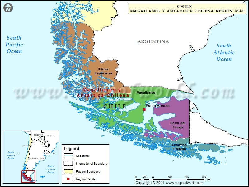
Provinces of Magallanes y Antartica Chilena Region |
| Province | Capital | Pop-2012 | Area(km.²) |
|---|---|---|---|
| Antártica Chilena | Puerto Williams | 1,792 | 15,854 |
| Magallanes | Punta Arenas | 128,199 | 38,401 |
| Tierra del Fuego | Porvenir | 6,656 | 22,593 |
| Última Esperanza | Puerto Natales | 18,685 | 55,444 |
Magallanes y Antartica Chilena Region is about taking glacier hikes and wading in high boots through the mud fields.
Magallanes y Antartica Chilena Region Attractions
Puerto Natales in Magallanes y Antartica Chilena region is a must watch tourist destination as there are huge glaciers in this region. The tourists can book the ships for watching some sparkling glaciers. The guests will be surprised to see the vast number of sea lions and cormorants. The beauty of Porvenir can be seen from Cerro Mirador. The pond in the nearby military base is the home to beautiful ducks and black necked swarms. Guanacos, nandus, penguins and condors are found in abundance in this region.
Magallanes y Antartica Chilena Region Activities
Tourism, oil extraction and bolvine farming are the main economic activities of Magallanes y Antartica Chilena Region in Chile. The region of Magallanes y Antartica Chilena also hosts some adventure races.
The virgin beauty of Magallanes y Antartica Chilena Region attracts tourists from all parts.

 Pantagonia Region