Lake Titicaca is among the highest navigable lakes in the world
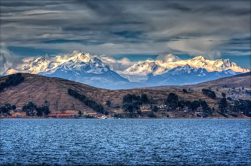
With a looming backdrop of Cordillera Real mountain range under azure sky, Lake Titicaca is draped in mythology of ancient civilizations. A haven for ecotourists, this lake is named so for its shape resembling a leaping puma. To unfold the mystery of traditional villages and unique customs, get down to this divine landscape that exudes a rich history. The originality and true essence of this place remain unchanged for many centuries with indigenous people (descendants of pre-Columbian empires) leading self-sufficient lives as craftsmen and fishermen.
History
Before being conquered by the Spanish in the 16th century, this region was home to the Inca Empire and the birthplace of King Manco Capac. This is the place where, according to the Incan Mythology, God Viracocha appeared from the lake and created the world. In 2000, an international archaeological expedition found an ancient temple submerged in the depths of the Lake.
Things to Do in Lake Titicaca
Taking a ride in ubiquitous puma-head boats, staying overnight in one of the islands, and soaking the native folklore, there are plenty of activities to choose from. Travelers are drawn to this place to see Islas Flotantes, otherwise known as the Lake Titicaca Floating Islands.
The Floating Islands – A group of around 44 artificial islands is the main point of interest in the lake. Deeply immersed in cultural inheritance of the Uros people, these islands are made of local totora reeds. Day tours from Puno to these islands offer an insight into local spiritual practices and ethereal way of living. Amantani and Taquile are two other remarkable islands, located in Peruvian side of the lake.
On the Bolivian side, Isla del Sol (Island of the Sun) is home to about 800 families. On the rocky terrain of this island in Challapampa village, over 180 ruins, Chinkana (a labyrinthine structure), and several sacred sites of the Inca Empire are present. Isla de la Luna (Island of the moon), inhabited by Tiwanaku people, is a UNESCO World Heritage Site due to its Aymara cultural value, Inca steps, and a fountain of youth. Suriki Island is perhaps the last place in this region where locals still produce reed boats.
Shopping – Less than 10-minute walk from the shore to railroad tracks, every Saturday, local residents hold a public market in Puno. Fruits, vegetables, Peruvian potatoes, and woolen clothing are the highlights in about dozen streets of this open-air market.
Wildlife – Titicaca National Reservation is a diverse ecosystem and home to waterfowls and birds (Puna Ibis, Chilean flamingo, and Grebe); mammals (Andean Wild Wolf, Llama, and Alpaca); fishes and endemic giant frogs.
Nearby Attractions
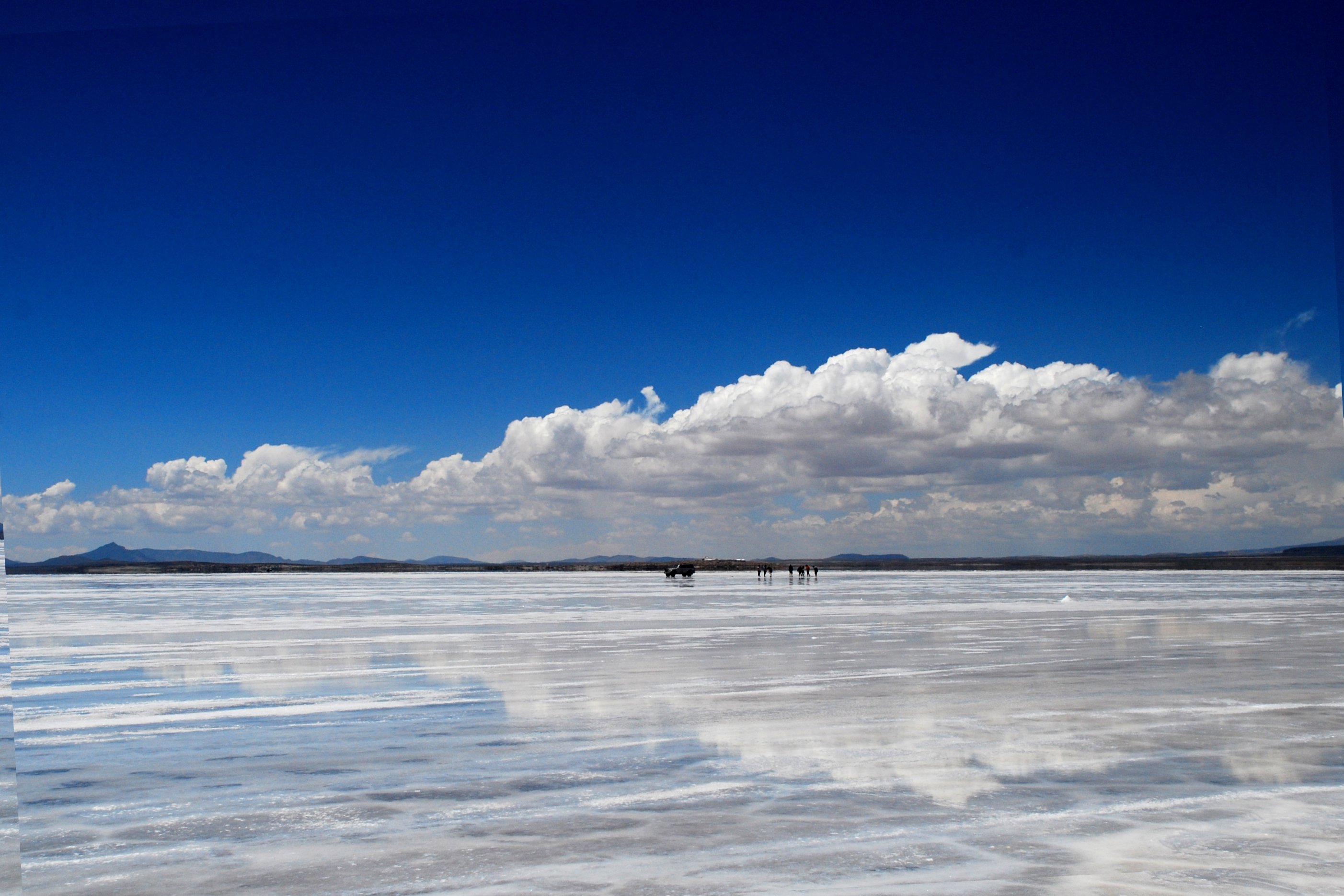
Titicaca National Reservation, Zona Reservada Cerro Khapia, Sillustani, and Salar de Unuyi.
Where is Lake Titicaca?
This landlocked lake spans across the Altiplano region in the Andes on the border of Bolivia (eastern side) and Peru (western side).
How to Reach?
By Air – Inca Manco Cápac International Airport in Juliaca (Peru) and El Alto International Airport in El Alto (Bolivia) are the gateways to the lake. Copacabana Airport in La Paz (Bolivia) is a small but efficient public airport served by regional flights.
By Train – In Peru, trains between Cusco and Puno travel thrice a week. In Bolivia, FFCC Train Station in La Paz is the closest one.
By Road – Puno (in Peru) and Copacabana (in Bolivia) are the towns located on the shores of Lake Titicaca. Puno is connected by Highway 34 and 3S to Peruvian cities such as Juliaca, Arequipa, and Cusco. Copacabana is accessible by Highway 3 and Highway 16 runs along the shore of this lake.
By Water – SS Ollanta, a steamship owned by PeruRail, is used as passenger and cargo transportation within the lake.
Accommodations
There is nothing more blissful than doing a home-stay in one of the islands. Furthermore, Copacabana has a reasonably good tourist infrastructure given its small area. You can choose to stay at Hotel Utama, Hotel Rosario Del Lago, Hostal La Cúpula, and Hotel Onkel Inn. In Puno, Intiqua Hotel, Qelqatani Hotel, Hotel Balsa Inn, and Sol Plaza Hotel are recommended for comfortable stays.
Restaurants
Mojsa Restaurant, La Casona Restaurant, and Casa Grill serve authentic Peruvian cuisine in Puno. To try fresh salmon trouts in Copacabana – the culinary capital of Bolivia – Mercado Copacabana, Maurez Restaurant, and Cafe Bistrot Copacabana Bolivia are recommended.
Best Time to Visit Lake Titicaca
Although accessible throughout the year, the most pleasant time to visit the Lake is between November and February. On the first Sunday of February, you can attend the Fiesta de la Candeleria in Puno and Fiesta de la Virgen de Copacabana in Bolivia. May to September is another time when climate is agreeable.
Lake Titicaca Facts
- It is the largest lake in South America by volume of water.
- With a surface elevation of 3,812 meters, it is among the highest navigable lakes in the world.
- “Taquile and its Textile Art” has been acknowledged by UNESCO as “Masterpieces of the Oral and Intangible Heritage of Humanity.”
- Lake Titicaca, a Ramsar wetland, is inhabited by more than 530 aquatic species.
- More than 25 river systems, mostly from Peru, feed into this lake.
- This freshwater lake in South America has a surface area of 8,372 sq. km. and an average depth of 107 meters.
- Two nearly separate basins – Lago Grande (larger) and Winaymarka (smaller) – are linked by the Strait of Tiquina.
Things to Remember
- Travelers are advised to stay hydrated and drink coca tea to relieve altitude sickness and headaches.
- Don’t forget to check current events and festivals in the region before planning a trip to Lake Titicaca.
- Bring sunglasses and suncream to protect yourself from strong UV rays.
- Most of the islands are not accessible by vehicles and you’ll need to travel on foot.
Image Credit: russavia
AS20151118