|
|
A monthly news
|
Map
letter on Maps, covering site
|
s of World
updates & new products
|
|
|
|
|
|
We at MapsofWorld.com, PrintableMapStore.com and WorldMapStore.com welcome you to February- the month of spring, resurgence and fast paced politico economic developments. Find out the latest updates and offers of our map portals in this edition of newsletter that are sure to keep you hooked.
|
|
|
|
|
|
|
|
|
|
|
|
|
|
|
|
|
|
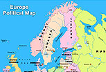
Europe one of the seven continents of the world comprises of key politico-economic countries of world. The map shows the political boundaries of the European countries like United Kingdom, France, Germany, Norway, Sweden, Italy, etc with their respective capitals. The water bodies like various oceans, seas and islands are also illustrated.
More...
|
|
|
|
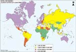
The map classifies the world countries on the basis of income per capita. The countries with high-income, upper middle income, lower middle income, and low middle income are illustrated with distinct color scheme. Besides this, a regional list featuring the income category of the various countries, which form a part of a given region is also provided.
More...
|
|
|
|
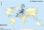
The section consists of maps on international groupings; NATO member countries, EU member countries, Commonwealth member countries, OPEC member countries, SAARC member countries, EFTA member countries etc . These maps are useful for the analysts and others interested in understanding the affiliations and equations of the countries.
More...
|
|
|
 |
| WORLD MAP STORE PRODUCT REVIEW |
|
|
 |
|
|
|
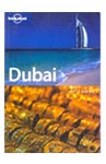 |
Lonely Planet: Dubai
Street smart and stylish travel guidebook covers Dubai-- the cosmopolitan city. Providing info on city's sophisticated culture and attractions-souqs, malls, and architectural wonders it is sure to make your trip a worthy experience.
|
|
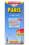 |
Paris Map: Berndtson & Berndtson
This laminated folded map of Paris city covers places of interest and includes detailed inset maps of the center of Paris, the location of Paris in France and the location of France in Europe. It also displays metro railway routes within Paris, the average temperature, humidity and rainfall statistics around the year. It is a handy tool for the
travelers and tourists.
|
|
|
|
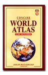 |
Concise World Atlas
The mini encyclopedia offers latest information of countries, continents and world in general. Covering Asia, Africa, Europe, North America, South America, Australia & Oceania, Polar regions it also provides some interesting facts on world.
|
|
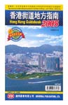 |
Hong Kong Guidebook
Discover Hong Kong -host to more than 6 million visitors each year with this compact and detailed bilingual guidebook. The book is packed with maps and offers information on the street plans of towns, NT West, Lantau, & Outlying islands, public transport facilities, leisure facilities, public facilities & services, schools & public libraries, streets etc.
|
|
|
|
|
| EXCLUSIVE OFFER OF THE MONTH |
|
|
|
|
|
|
|
|
|
Buy Maps of World CD worth US $ 50 and get a Britannica Concise Encyclopedia CD Rom worth US$ 22 absolutely free!
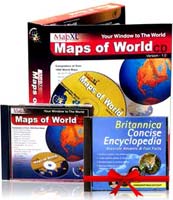 Maps of World CD is the best tool on world maps, containing over 1,000 maps of the world, its continents, countries and cities. The CD offers maps on polity, geography, economy, agriculture, international grouping, travel plus various useful tools like lat-long search, dialing codes etc. Almost all the maps are printable on an A4 sized paper, using your office or home printer.
Britannica Concise Encyclopedia with informative articles, engaging videos and dictionary takes you to the exciting world of discovery of treasure house of information.
Kindly click here to avail the offer
|
|
|
PrintableMapStore.com
|
|
PrintableMapStore.com brings to you the ready to use map image of world outline map.
The map shows the outline of the countries of the world while the water bodies are illustrated in blue.
|
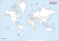
World Outline Map
|
The map can be customized as per desired specifications.The ready to use map image is available in A4, A3, A2, A1 and A0 size. It can be customized in desired size, style and format on request. The map image can be ordered in print resolutions of 72 to 300 DPI and is useful for publishing and advertising, presentations, project reports, brochures, broadcasting purposes etc.
Please visit www.printablemapstore.com to browse and order map images.
|
|
|
| If you do not wish to recieve newsletters please click here
|

|
Compare Infobase (P) Ltd
C-62, Janak Community Center, Janakpuri, New Delhi-58(India)
Tel: +91-11-515880121, 51588012, 25542045
Fax: +91-11-25547264
Email: [email protected]
We host With Serversindia.net Pvt. Ltd.
|
|
|

