What is the McMahon Line?

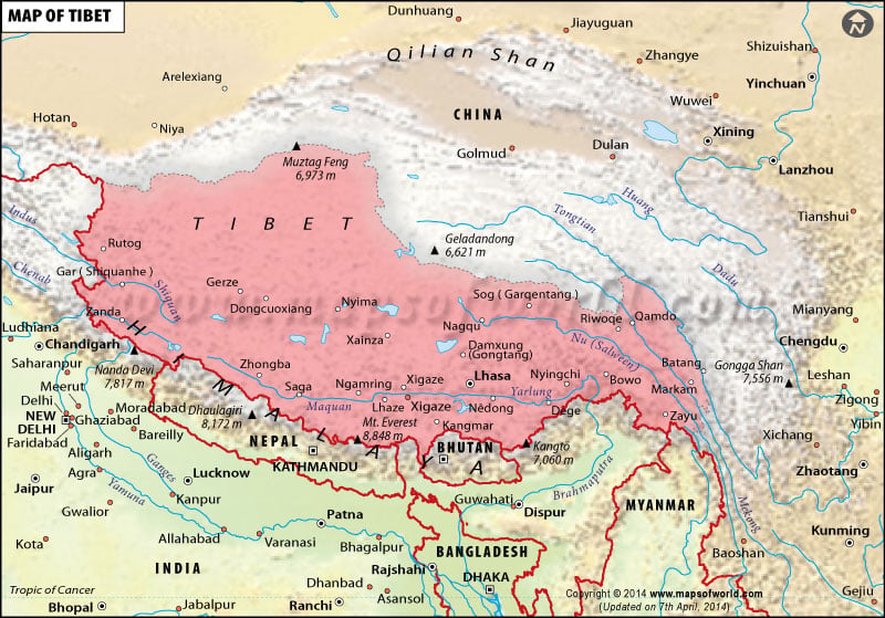
Named after the British Indian Army officer who was an administrator of India under the British colonial rule, Lieutenant Colonel Sir Arthur Henry McMahon, the McMahon line is a demarcation that separated Tibet and the north-east India. Colonel McMahon had proposed this line as the boundary between Tibet, China, and India at the Shimla Convention of 1914. It was accepted by Tibetan authorities and British India and is now acknowledged by the Republic of India as the official boundary. The People’s Republic of China, however, disputes the validity of the McMahon line because it considers Tibet to be an integral part of its territory.
The status of Tibet’s sovereignty has been a matter of much contention through the ages. The Chinese claim that Tibet has been an integral part of the country’s territory for several centuries. In the early 1900s with Britain showing an interest in the trade potential of the cities now considered part of north-east India, there were attempts by the British authorities to come up with a clearly demarcated border that divided China, India, Nepal, and Tibet. In 1873, Britain proposed that the arbitrary “Outer Line” it had been using be used as an international border and started to negotiate with Beijing to enforce this. The Tibetan leaders, however, refused to acknowledge this border.
Through the first decade of the 1900s Tibet was under the control of China but the British interests in the region kept growing. Following the Xinhai Revolution (1911-12), however, the Qing dynasty, the last ruling dynasty of imperial China, was overthrown and Republic of China (ROC) was established. It is at this time that Tibet declared itself independent in 1913. The Shimla Conference held between October 1913 and July 1914 was attended by British officials and representatives of China and Tibet in Shimla, India. The accord negotiated proposed dividing Tibet into “Outer Tibet” which would remain under the administration of the Dalai Lama’s government but would still be considered to remain under the “suzerainty” of China. “Inner Tibet” would be under the administration of Chinese authorities. This brought the 550-mile McMahon Line into existence. While Tibetan authorities agreed to the Shimla Accord, the Chinese representatives refused to sign it.
The McMahon line remained almost forgotten until the mid-1930s when British civil servant Sir Olaf Kirkpatrick Kruuse Caroe decided to enforce it by drawing up official maps of British India that showed the line as the official border. In 1947, the Tibetans moved to reject the line and claimed areas south of the McMahon line. In 1947 India became independent of British authority but the newly formed republic inherited the troubled border dispute that continues to unhinge cordial relations between India and the PCR. To this day, about 25,000 square miles of southern Tibet and north eastern India are claimed by China. The contention was the primary cause of the Sino-Indian War of 1962.
Related Links:


