What are the Key Facts of District of Columbia?

|
State |
District of Columbia (Not a state but federal district) |
|
Country |
United States of America |
|
ZIP Codes |
20001–20098, 20201–20599 |
|
Area code(s) |
202 |
|
Coordinates |
38°54′17″N 77°00′59″W |
|
Postal Abbreviation |
DC |
|
Area |
68.34 sq. mi, (177.0 sq. km) |
|
Highest Point |
409 ft (125 m) |
|
Population |
Federal capital city and federal district – 702,445 (2018 est.) |
|
Date of Entering the Union |
November 11, 1889 |
|
Anthem |
“Our Nation’s Capital” |
|
Mayor |
Muriel Bowser (Democratic Party) |
|
GDP (Millions of Dollars) |
1,40,661 |
|
Demonym |
Washingtonian |
|
Time Zones |
UTC−5 (EST), Summer (DST) UTC−4 (EDT) |
Is District of Columbia or Washington DC a State?
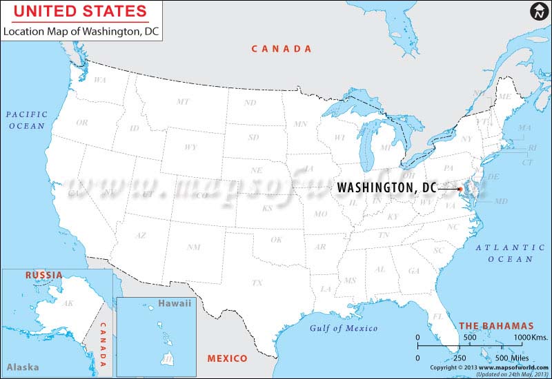
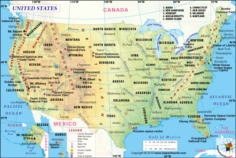
The District of Columbia (commonly called Washington DC), is a federal district and not a state. It is the capital of the United States of America. Washington DC or the District of Columbia should not be confused with Washington (state), located on the US West Coast.
In 1787, at the time of the adoption of the Constitution of the United States, the area encompassing the current District of Columbia was part of Maryland. However, for making it the capital of the US, the District of Columbia was ceded to the federal government in 1791. The US Congress currently governs this District.
Where is the District of Columbia?
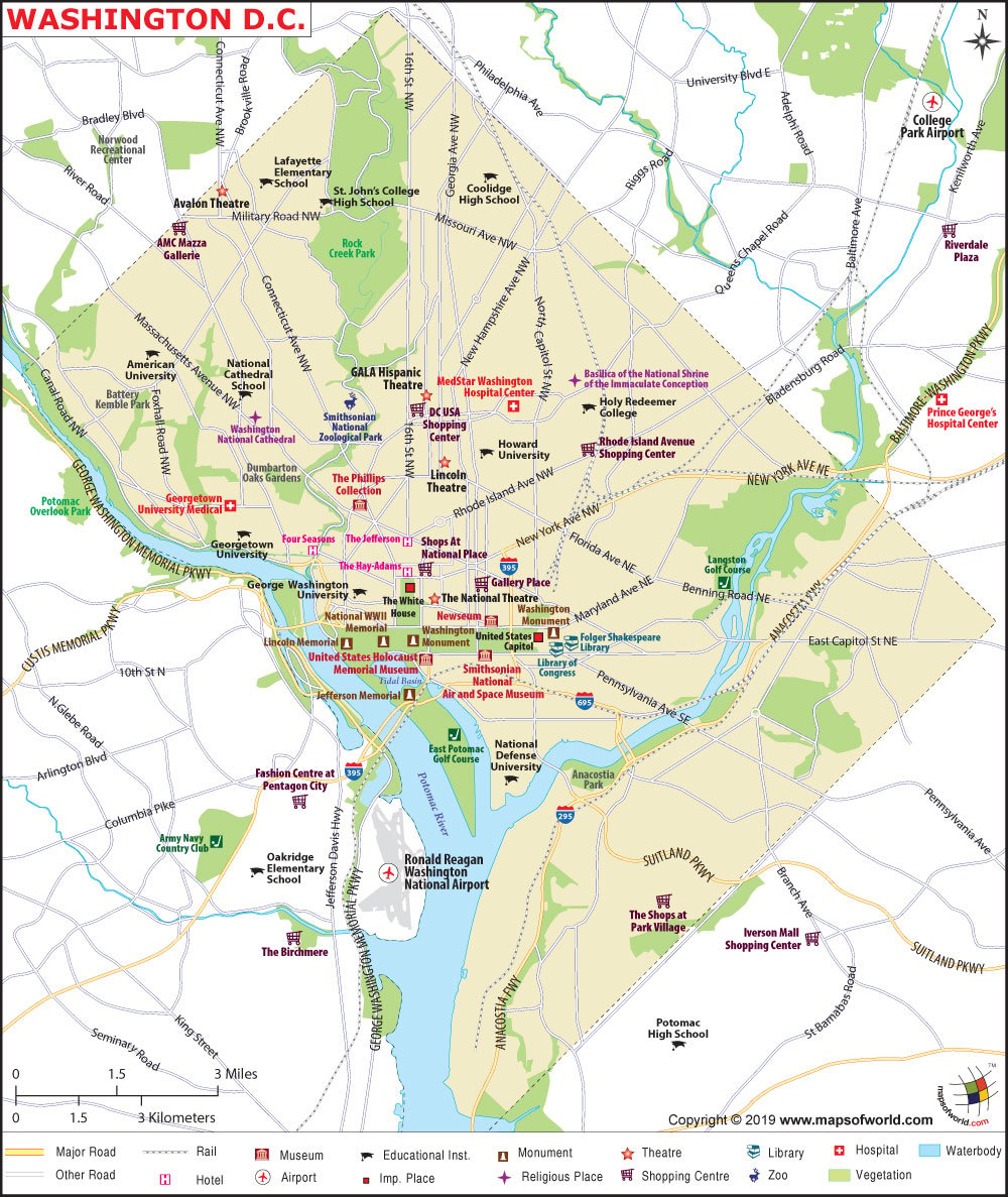
The District of Columbia is located on the West Coast of the northwestern United States. It shares its border with Virginia’s Alexandria to the west, Virginia’s Arlington County to the south, Maryland’s Prince George County to the east, and Maryland’s Montgomery County to the northwest.
What is the Geography of the District of Columbia?
The total area of the District of Columbia is 68.34 sq. mi (177 sq. km), out of which 61.05 sq. mi (158.1 sq. km) is land area and 7.29 sq. mi (18.9 sq. km) is the water area. The water area covers 10.3 % of the total area.
Some of the major rivers and creeks here are Potomac River, Anacostia River, Watts Branch, Tiber Creek (Goose Creek), Hickey Run, Foundry Branch, Maddox Branch, Pope Branch, Oxon Creek, Piney Branch, Pinehurst Branch, and Oxon Run.
The mean elevation of the Washington DC is 89 ft (27 m). While Tenleytown’s Reno Reservoir at 410 ft (125 m) is the highest elevation point, the Potomac River at 1 ft (0.3 m) is the lowest elevation point in the District of Columbia. The place near 4th Street NW, L Street NW, and New York Avenue NW is the geographic center of the Washington DC. The Capitol dome is the point where the four administrative quadrants of the District take place.
Most of the landforms in the central part of the District of Columbia is flat. From the flatlands on the banks of the Potomac River, the landform gradually rises and eventually it is being surrounded by rolling land in the south and low hills in the north. Through the eastern edge of the District, the Anacostia River flows.
The historic Arsenal Point peninsula is located in the Potomac-Anacostia confluence. The Washington Channel flows into the Anacostia-Potomac river junction. There are three man-made reservoirs, and they are Dalecarlia Reservoir, McMillan Reservoir, and Georgetown Reservoir. At Tenleytown’s Fort Reno, a minor water reservoir can also be located.
What is the Climate of District of Columbia?
A humid subtropical climate is found in the national capital. It is characterized by cold winters and hot/humid summers. The nearness of the place influences the District of Columbia’s climate to the east coast as well as the Atlantic Ocean.
The season of summer gets lots of sunshine. The temperature peaks in July and the average high during this month is around 31.3 °C (88.4 °F). The seasons of spring (March-May) and autumn/fall (September-November) are prominent, during which the climate remains pleasant as well as less humid. The winter chill becomes absent during springtime, and the weather remains warm (with the temperature ranging within 60-70 °F (15.6-21.1 °C).
January is the coldest month during the winter season when the average low temperature reaches 28.6°F (-1.9°C). During winter, snowfall is common. The extent of snow can reach 15 inches (381 mm). The level of rainfall is evenly distributed across the year. Destructive tornadoes, as well as thunderstorms, occasionally accompany the rain and the annual level of rain reaches 40 inches (1016mm).
Spring and fall/autumn are the best time to visit the District of Columbia because, during this time, the stickiness/heat of summer becomes non-existent, and the fall foliage soothes the eyes.
What is the Economy of the District of Columbia?
The District of Columbia’s economy is a growing and diversified one. Its total Gross Domestic Product (GDP) has increased from US$100,894.6 million in 2009 to US$140,660.9 million in 2018. Reports say that the percentage of professional and business service jobs in Washington DC is increasing. The unemployment rate has come down from a peak of 10.5% in July ’11 to 5.3% in Nov’19.
The Real Median Household Income in the District has increased from US$62,346 in 2009 to US$85,750 in 2018. The Per Capita Personal Income has shot up from US$60,448 in 2009 to US$82,005 in 2018. In July ’19, the total exports and imports were US$268.57 and US$40.5 million respectively, resulting in a positive trade balance of US$228.05 million. In 2018, the value of exports and imports were US$2,724,645,751 and US$761,474,519 respectively, resulting in a trade surplus of US$1,963,171,232.
The major export items are bomb mines OT ammunition, pt electric machines and apparatus with individual functions, parts of airplanes or helicopters, exports of military equipment, trucks, boring or sinking mach, not self-propelled, paintings, drawing and pastels by hand, radar apparatus, etc.
The major import items are digital processing units, parts and accessories for Adp m, paintings, drawing and pastels by hand, composite diagnostic/lab reagents, pharmaceuticals, digital Adp mac and units, peanuts, prepared or preserved, etc.
As per the 2018 American Community Survey (1-year estimate), 16.2% of the total population in Washington DC lives in poverty.
What is the Transportation System of District of Columbia?
The transportation system is mainly dependent upon the District Department of Transportation (DDOT), which plans, designs, constructs, and maintains streets, sidewalks, bridges, alleys, and city streets. The major airports in Washington DC are Ronald Reagan Washington National Airport (in Virginia), Baltimore/Washington International Thurgood Marshall Airport, Washington Dulles International Airport, etc. Metrorail and Metrobus are prevalent modes of transportation to move around in the capital.
What are the nicknames of the District of Columbia?
District of Columbia is known by various nicknames such as “DC”, “Chocolate City”, “Hollywood for Ugly People The Federal City”, “The District, Murder Capital of America”, “Executive City”, “Great White City”, “City of Magnificent Intentions”, “City of Magnificent Distances”, “Capital Of America”, “Capital Of The Vast”, “The Capital of the World”, “Republic and Capital City” and “The American Rome”.
What are the Popular Tourist Attractions in District of Columbia?
United States Capitol and Capitol Hill, The White House, The Lincoln Memorial, The Washington Monument, National Mall and Veterans Memorials, National Air and Space Museum, National Gallery of Art, National Museum of Natural History, National Zoological Park, National Museum of American History, Jefferson Memorial and Tidal Basin, Arlington National Cemetery, Newseum, International Spy Museum, National Museum of African American History and Culture, Washington National Cathedral
Related Links:


