1.2K
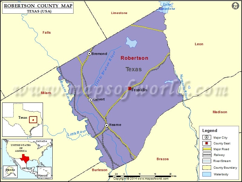
Check this Texas County Map to locate all the state’s counties in Texas Map.
Mountain Peaks in Robertson County
| Mountain Peak/Hill | Elevation [Meter] |
|---|---|
| Red Hill | 143 |
More Maps of Robertson County
Airports in Robertson County
| Airport Name |
|---|
| Corpora Airport |
| Hearne Municipal Airport |
| Putz Aero Inc Airport |
| Rmr Ranch Airport |
| Sandbur Ranches Private Airport |
Cities in Robertson County
| City | Population | Latitude | Longitude |
|---|---|---|---|
| Bremond city | 929 | 31.165709 | -96.675975 |
| Calvert city | 1192 | 30.979149 | -96.671542 |
| Franklin city | 1564 | 31.02548 | -96.485643 |
| Hearne city | 4459 | 30.87698 | -96.595579 |
Golf Courses in Robertson County
| Name of Golf Course | Latitude | Longitude |
|---|---|---|
| Calvert Country Club-Calvert | 30.91327 | -96.682309 |
| Hearne Municipal Golf Course-Hearne | 30.884813 | -96.585871 |
 Wall Maps