902
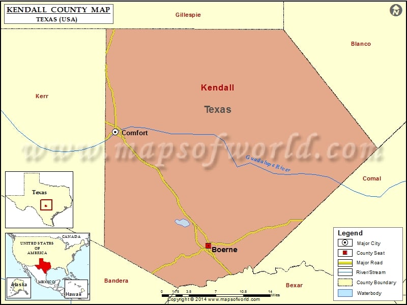
Check this Texas County Map to locate all the state’s counties in Texas Map.
Mountain Peaks in Kendall County
| Mountain Peak/Hill | Elevation [Meter] |
|---|---|
| Big Hill | 612 |
| Bust Buttes | 565 |
| Cannon Hill | 560 |
| Cave Hill | 566 |
| Cedar Mountain | 564 |
| Dunners Mountain | 565 |
| Jungfrau | 558 |
| Lone Hill | 555 |
| Malakopf Hill | 537 |
| Meta Mountain | 579 |
| Mount Rigi | 541 |
| No Name Hills | 589 |
| Rattlesnake Mountain | 577 |
| Ring Mountain | 535 |
| Round Mountain | 487 |
| Sabinas Mountain | 567 |
| Schleicher Mountain | 528 |
| Smith Hill | 494 |
| Turkey Knob | 623 |
| Wolf Mountain | 571 |
Airports in Kendall County
| Airport Name |
|---|
| B. J. Mc Combs Sisterdale Airport |
| Diamond K Ranch Airport |
| Double U Ranch Airport |
| Grier Airport |
| Headwaters Airport |
| John Henry Key Airport |
| Rust Field |
| Wallace Ranch Airport |
Cities in Kendall County
| City | Population | Latitude | Longitude |
|---|---|---|---|
| Boerne city | 10471 | 29.785407 | -98.732211 |
| Comfort | 2363 | 29.971411 | -98.903999 |
Golf Courses in Kendall County
| Name of Golf Course | Latitude | Longitude |
|---|---|---|
| Buckhorn Golf Course-Comfort | 29.971399 | -98.891905 |
| Tapatio Springs Country Club & Resort-Boerne | 29.79525 | -98.749924 |
| The Clubs of Cordillera Ranch-Boerne | 29.840566 | -98.608943 |
 Wall Maps