1.1K
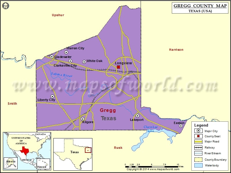
Check this Texas County Map to locate all the state’s counties in Texas Map.
Airports in Gregg County
| Airport Name |
|---|
| East Texas Regional Airport |
| Gladewater Municipal Airport |
| Good Shepherd Medical Center Heliport |
| Kilgore Airport |
| Roy H Laird Memorial Hospital Heliport |
| Tailwheel Airport |
Cities in Gregg County
| City | Population | Latitude | Longitude |
|---|---|---|---|
| Clarksville City city | 865 | 32.532834 | -94.894486 |
| Easton city | 510 | 32.38193 | -94.591243 |
| Gladewater city | 6441 | 32.54347 | -94.945265 |
| Kilgore city | 12975 | 32.395206 | -94.863073 |
| Lakeport city | 974 | 32.405054 | -94.710171 |
| Liberty City | 2351 | 32.450208 | -94.94383 |
| Longview city | 80455 | 32.519286 | -94.762198 |
| Warren City city | 298 | 32.55301 | -94.905793 |
| White Oak city | 6469 | 32.531287 | -94.856378 |
Golf Courses in Gregg County
| Name of Golf Course | Latitude | Longitude |
|---|---|---|
| Longview Country Club-Longview | 32.488 | -94.850534 |
| Meadowbrook Country Club-Kilgore | 32.37956 | -94.860915 |
| Pinecrest Country Club-Longview | 32.490818 | -94.704554 |
| Southern Hills Golf Club-Gladewater | 32.458455 | -94.929602 |
| The Challenge At Oak Forest-Longview | 32.539315 | -94.766764 |
| Wood Hollow Golf-Longview | 32.566461 | -94.769869 |
 Wall Maps