1.2K
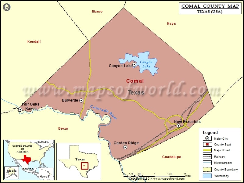
Check this Texas County Map to locate all the state’s counties in Texas Map.
Mountain Peaks in Comal County
| Mountain Peak/Hill | Elevation [Meter] |
|---|---|
| Bading Hill | 203 |
| Baldy Mountain | 345 |
| Big Head Mountain | 450 |
| Devils Hill | 466 |
| Kuhn Hill | 405 |
| Mission Hill | 292 |
| Nail Hill | 215 |
| Startz Hill | 428 |
Airports in Comal County
| Airport Name |
|---|
| Bat Cave Field |
| Bear Creek Ranch Airport |
| Bulverde Airpark |
| Canyon Lake Airport |
| Dean Ranch Airport |
| Flying J Airport |
| Flying R Ranch Airport |
| Fox Airport |
| Grosser Airport |
| Holler Heliport |
| Kestrel Airpark |
| Kitty Hawk Flying Field |
| Mc Coy Bldg Sup 16 Heliport |
| Mckenna Memorial Hospital Heliport |
| Rancho Del Lago Heliport |
Cities in Comal County
| City | Population | Latitude | Longitude |
|---|---|---|---|
| Bulverde city | 4630 | 29.77233 | -98.437311 |
| Canyon Lake | 21262 | 29.876218 | -98.261671 |
| Fair Oaks Ranch city | 5986 | 29.744271 | -98.638636 |
| Garden Ridge city | 3259 | 29.63792 | -98.292599 |
| New Braunfels city | 57740 | 29.699406 | -98.115507 |
Golf Courses in Comal County
| Name of Golf Course | Latitude | Longitude |
|---|---|---|
| Canyon Lake Golf Club-Canyon Lake | 29.854358 | -98.25443 |
| Landa Park Municipal Golf Course-New Braunfels | 29.711277 | -98.132716 |
| River Crossing Golf Club-Spring Branch | 29.845997 | -98.404065 |
| The Hawk Golf Club-Spring Branch | 29.915304 | -98.367932 |
 Wall Maps