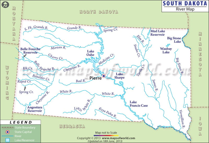
Vermillion, James, Missouri, Cheyenne, White, Big Sioux, Moreau and Grand are among the main rivers of South Dakota.
The state of South Dakota falls under the watershed of the Gulf of Mexico. However, some of the northeastern parts of the state are also found under the watershed of Arctic Ocean. Missouri river, being one of the prominent waterways of South Dakota, flows towards the southeastern and southern parts of the state. South Dakota River Map clearly points out the various waterways of the state. While Moreau, White, Cheyenne, Grand and Bad rivers flow towards the eastern direction of the state, rivers like Vermillion, James and Big Sioux flow towards the south.
All the major rivers of South Dakota meet Missouri river. Big Stone and Traverse are the two main lakes on the northeast of South Dakota. Lake Thompson, the largest natural lake of the state, is on the east-central region of South Dakota. The river map of South Dakota also marks Little White river, Lake Sharpe, Keya Paha river, Lake Oahe, Angostura Reservoir, Sanke Creek, Belle Fourche Reservoir, and Spring Creek, among others. The South Dakota state map is also an useful indicator of the natural streams, lakes and rivers of the place.
 Wall Maps