3K
- South Carolina Counties - South Carolina County Map, Map of South Carolina Counties,
- Major Cities of South Carolina -
- Neighbouring States - North Carolina, Georgia
- Regional Maps - Map of USA
- Other South Carolina Maps - South Carolina Map, South Carolina Physical Map, South Carolina Airports Map, South Carolina Lat Long Map, South Carolina Zip Code Map, South Carolina Area Code Map, South Carolina National Parks Map
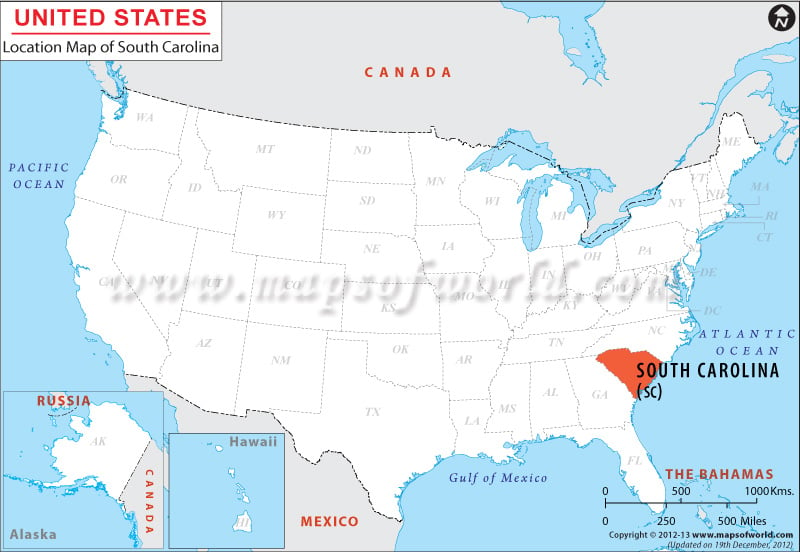
Located in the southeastern part of USA, the State of South Carolina is spread over total area of 31,113 square miles. The Latitude & Longitude of the state are 34.0° N, 81.0° W. South Carolina shares its northern and northeastern borders with North Carolina, southeastern border with the Atlantic Ocean and western and southwestern border with Georgia.
Facts About South Carolina |
|---|
| State Name | South Carolina |
|---|---|
| Continent | North America |
| Country | United States (USA) |
| State | South Carolina (SC) |
| Capital and largest city | Columbia |
| Area | 32,020 sq mi (82,931. km2) |
| Population | 4,832,482 (2014 est) |
| Lat Long | 34° 0′ 0″ N, 81° 0′ 0″ W |
| Official Language | English |
| Calling Code | 00 1 803 X |
| Time Zone | Eastern: UTC -5/-4 |
| Airport | 6-Commercial Airports |
| Neighbour State | North Carolina, Georgia |
| Internet TLD | |
| Currency | United States Dollar (USD) |
 Wall Maps