- South Carolina Counties - South Carolina County Map, Map of South Carolina Counties,
- Major Cities of South Carolina -
- Neighbouring States - North Carolina, Georgia
- Regional Maps - Map of USA
- Other South Carolina Maps - South Carolina Map, Where is South Carolina, South Carolina Airports Map, South Carolina Lat Long Map, South Carolina Zip Code Map, South Carolina Area Code Map, South Carolina National Parks Map
South Carolina Physical Map
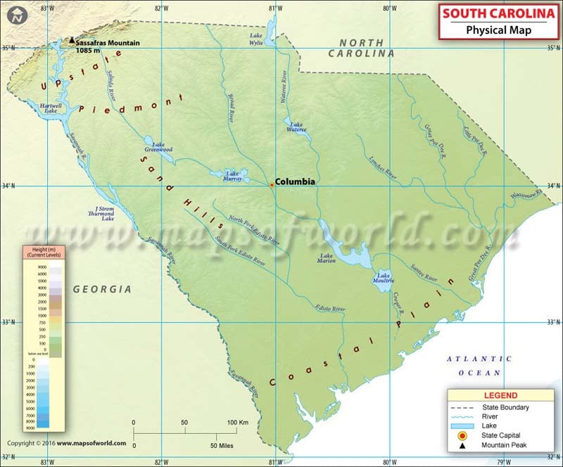
From western highlands to eastern lowlands, South Carolina features varied geography. The physical regions of South Carolina can be understood in following divisions:
The hilly Upstate South Carolina is the westernmost region South Carolina. Its northwestern edge features the Appalachian Mountains and the Blue Ridge Mountains. Sassafras Mountain, which is South Carolina’s highest point at 1,090 meters, is located in the region. By area, this hilly region is the smallest region in the state.
The Midlands are located in the heart of South Carolina. Just southeast of the Blue Ridge is the Sandhills region. The area used to be an ancient sea coast millions of years ago. From east to west, the land rises gently into forested sand hills, and further into the rolling hills of the Piedmont Plateau. Average elevations in the Piedmont Plateau are near 1,000 ft above sea level. The Fall Line marks the boundary of the Sandhills and the Piedmont.
The Lowcountry region extends along South Carolina’s coast and is the largest physical region in terms of area. The Atlantic Coastal Plain is divided into the Outer and Inner Coastal Plains. The coastline of South Carolina features plenty of salt marshes and estuaries. The terrain is flat and swampy along the coastline while inland plains have rich sediments ideal for farming. Moreover, a string of sea islands lies off the southeastern Atlantic Coast.
 Wall Maps