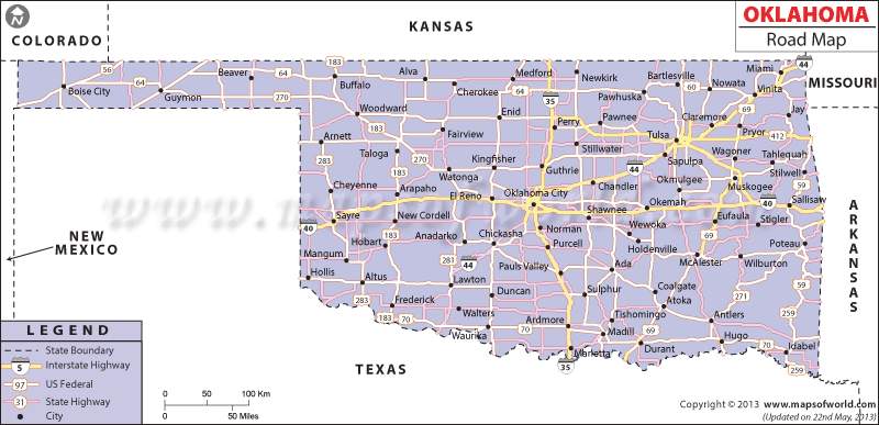
The Oklahoma Road Map clearly marks the several roads, streets and highways of the state.
The important towns of Oklahoma are connected by the state and national highways of the state. The northern and the southern part of Oklahoma are joined by the Interstate Highway of 35. The eastern end of Oklahoma is connected to the western end of the state by the Interstate Highways of 40 and 44. The road route of I-44 runs through the cities of Oklahoma and Tulsa. Another prominent road route of I-35 makes the towns of Kansas, Dallas and Topeka easily accessible.
The state had a length of 181,266 kilometer of total roadways running through Oklahoma in the year of 2000. During 2000, Oklahoma had 3,072,137 registered motor vehicles which comprised 1,410,783 trucks and 1,587,115 cars. The US Highways of Oklahoma facilitate easy communication in the state. Some of the important US Highways of the state are 81, 70, 283, 69, 259 and 77. The Oklahoma State Map highlights the towns that are joined by the roadways of the state. The major towns of Oklahoma City, Stillwater, Norman, and Moore are connected by the several national and state highways of the state.
 Wall Maps