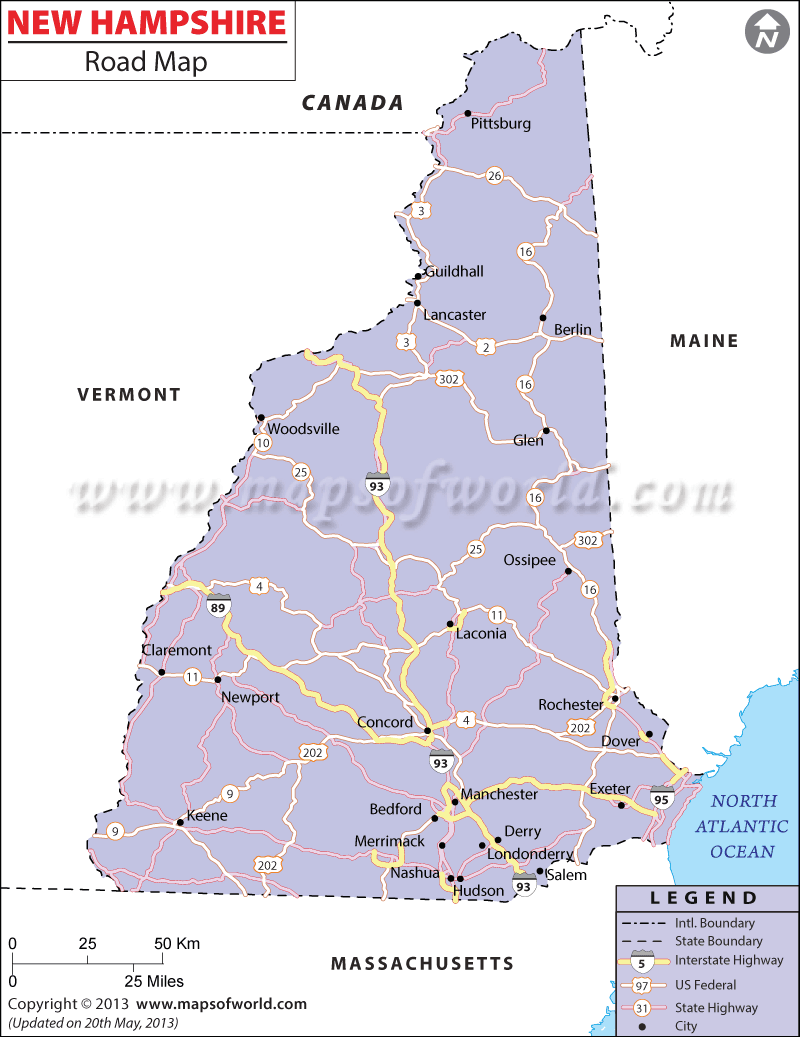
Interstates 89, 93, and 95 are the three major roadways in the state of New Hampshire. The New Hampshire Road Map locates the routes through which the state highways pass. Cities and towns connected via the interstate roads are also shown in the road map of New Hampshire. The locations falling under the north-south direction of the state are easily accessible through these major interstates.
Equipped with a total of 15,210 miles of public roads, the state of New Hampshire has 2,938 miles of urban roadways and 12,272 miles of rural roads, according to a 2000 survey. Buses and motorcycles are the common mode of road transportation in New Hampshire. With 1,733 buses and 48,651 motorcycles, New Hampshire boasts of a well-developed transportation infrastructure. The New Hampshire State Map provides a vivid illustration of the road network spread across the entire region.
The New Hampshire Road Map details the following cities and towns: Brattleboro, Colebrook, Glen, Nashua, Newport, Plymouth, Woodsville, and others, including the capital city of Concord.
 Wall Maps