- Montana Counties - Montana County Map, Map of Montana Counties
- Major Cities of Montana - Helena
- Neighbouring States - South Dakota, North Dakota, Wyoming, Idaho
- Regional Maps - Map of USA
- Other Montana Maps - Montana Map, Where is Montana, Montana Airports Map, Montana Lat Long Map, Montana Zip Code Map, Montana Area Code Map, Montana National Parks Map
Physical Features of Montana
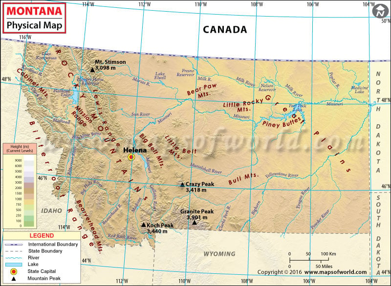
Located in the southwestern region of the United States, Montana is largely a mountainous state. Montana shares its borders with the US states of North Dakota, South Dakota, Wyoming, and Idaho. It also shares its borders with the Canadian provinces of British Columbia, Alberta, and Saskatchewan and is the only state in the United States which has a 545 mile long international border with three provinces of Canada. While the western part comprises mountainous ranges, the eastern part is composed of badlands and western prairie terrain. Around 77 ranges in the state are a part of the Rocky Mountains. The state also has many isolated island ranges. Around 60 percent of Montana is prairie.
One of the prime mountain ranges in the state is the Bitterroot Mountains, which long with some smaller ranges, separates Montana from Idaho. Some other mountain ranges situated in the state include Flint Creek Range, the Anaconda Range, the Cabinet Mountains, the Garnet Range, and may others. Some important rivers in the state are Flathead River, Blackfoot River, Big Hole River, Ruby River, and Jefferson River to name a few.
The map gives the user an insight into the physical features of the state. Listed on it are the prominent mountain ranges, rivers and other features. The map is useful for tourists, geographers, students and teachers.
MOW.PB.14.12.2016
 Wall Maps