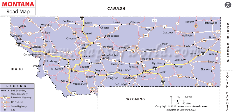
The state and national highways, roads and streets of the state are clearly marked in the Montana Road Map.
The well maintained roads of Montana comfortably connect all the important cities and towns of the state. The northern part of the state is easily accessible from the southern part of Montana by the Interstate highway of 15. The Interstate Highway of 90 and Interstate 94 joins the eastern and western ends of the state. Some other important road routes of Montana that help in the easy connectivity of the state are the US Highways of 2, 87, 12, 212, 191, 310, 89, and 93. The State of Montana had total length of 69,567 miles of national and state highways, roads and streets in the year of 2006. In that same year, Montana had 1,052,737 registered motor vehicles, (specifically, 466,659 cars, 556,772 trucks and 2,795 public and private buses), and had issued driving licenses to 678,899 drivers.
Montana Interstates:
North-South interstates include: Interstate 15.
East-West interstates include: Interstate 90 and Interstate 94
Montana Routes:
US Highways and State Routes include: Route 2, Route 12, Route 87, Route 89, Route 93, Route 191, Route 212, Route 287 and Route 310.
 Wall Maps