1.4K
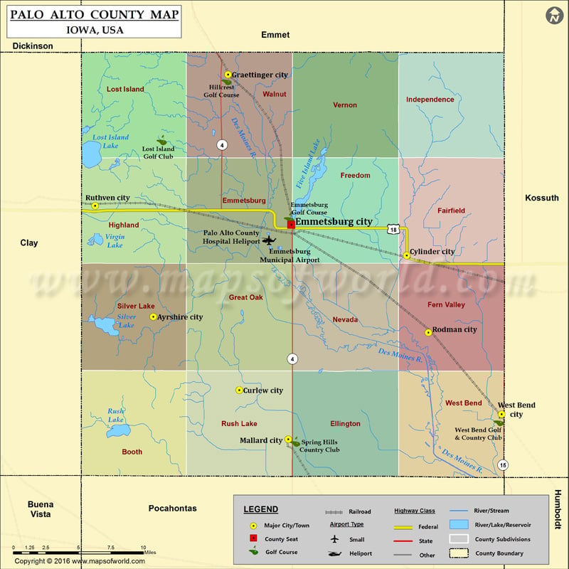
Airports in Palo Alto County
| Airport Name |
|---|
| Emmetsburg Municipal Airport |
| Palo Alto County Hospital Heliport |
Cities in Palo Alto County
| City | Population | Latitude | Longitude |
|---|---|---|---|
| Ayrshire city | 143 | 43.039552 | -94.833523 |
| Curlew city | 58 | 42.979527 | -94.737734 |
| Cylinder city | 88 | 43.089585 | -94.551362 |
| Emmetsburg city | 3904 | 43.114586 | -94.679966 |
| Graettinger city | 844 | 43.237071 | -94.750424 |
| Mallard city | 274 | 42.93939 | -94.68316 |
| Rodman city | 45 | 43.02659 | -94.527183 |
| Ruthven city | 737 | 43.130091 | -94.89845 |
| West Bend city | 785 | 42.959941 | -94.445676 |
Golf Courses in Palo Alto County
| Name of Golf Course | Latitude | Longitude |
|---|---|---|
| Emmetsburg Golf Course-Emmetsburg | 43.120342 | -94.682342 |
| Hillcrest Golf Course-Graettinger | 43.23265 | -94.752009 |
| Lost Island Golf Club-Ruthven | 43.183739 | -94.824294 |
| Spring Hills Country Club-Mallard | 42.937433 | -94.675709 |
| West Bend Golf & Country Club-West Bend | 42.95424 | -94.448909 |
 Wall Maps