1.1K
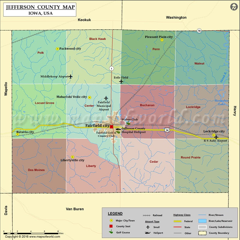
Airports in Jefferson County
| Airport Name |
|---|
| Estle Field |
| Fairfield Municipal Airport |
| Jefferson County Hospital Heliport |
| Middlekoop Airport |
| R S Auto Airport |
More Maps of Jefferson County
Cities in Jefferson County
| City | Population | Latitude | Longitude |
|---|---|---|---|
| Batavia city | 499 | 40.995102 | -92.167393 |
| Fairfield city | 9464 | 41.007043 | -91.967273 |
| Libertyville city | 315 | 40.958243 | -92.050196 |
| Lockridge city | 268 | 40.993701 | -91.749221 |
| Maharishi Vedic City | 259 | 41.05433 | -92.013883 |
| Packwood city | 204 | 41.132725 | -92.082476 |
| Pleasant Plain city | 93 | 41.147216 | -91.859629 |
Golf Courses in Jefferson County
| Name of Golf Course | Latitude | Longitude |
|---|---|---|
| Fairfield Golf & Country Club-Fairfield | 40.999699 | -91.953414 |
| Walton Club-Fairfield | 41.013576 | -91.931811 |
 Wall Maps