1.1K
Mountain Peaks in Woodford County
| Mountain Peak/Hill | Elevation [Meter] |
|---|---|
| Nichols Mound | 205 |
Airports in Woodford County
| Airport Name |
|---|
| Corn Alley Airport |
| Davison Restricted Landing Area |
| Jay Schertz Farm Airport |
| John D Rennick Airport |
| Mesa View Ranch Airport |
| Michael Pfister Airport |
| Oltman-Shuck Airport |
| Unzicker Airport |
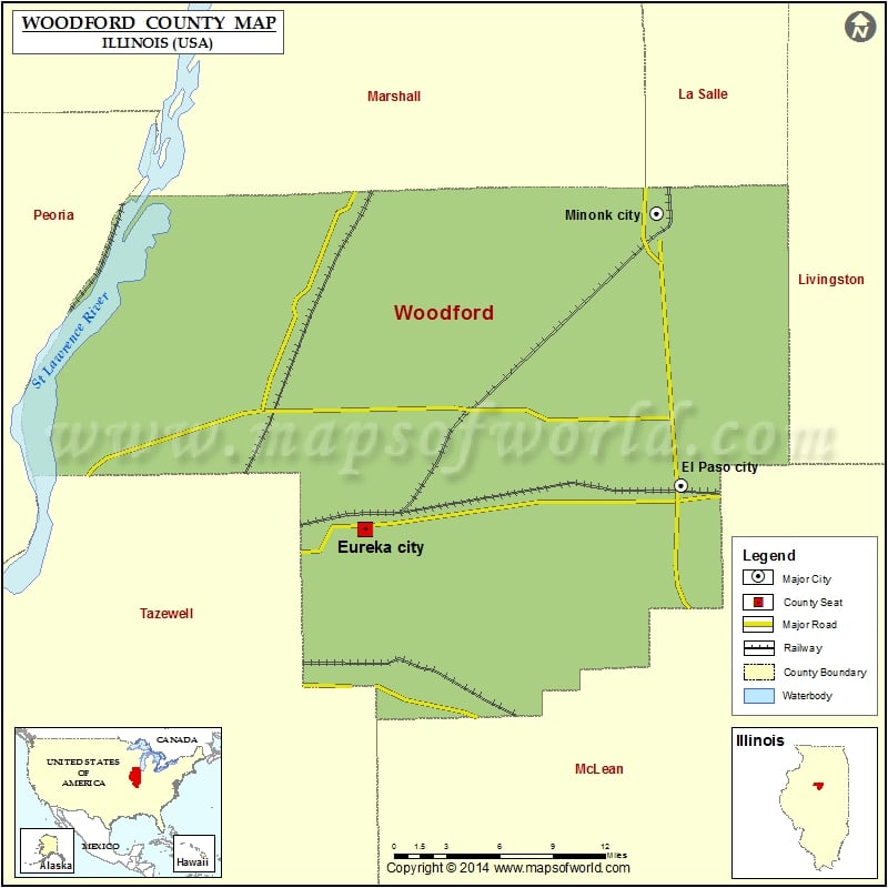
Cities in Woodford County
| City | Population | Latitude | Longitude |
|---|---|---|---|
| Bay View Gardens village | 378 | 40.809938 | -89.523394 |
| Benson village | 423 | 40.850619 | -89.121041 |
| Congerville village | 474 | 40.617174 | -89.204067 |
| El Paso city | 2810 | 40.740588 | -89.018104 |
| Eureka city | 5295 | 40.71331 | -89.277834 |
| Germantown Hills village | 3438 | 40.771826 | -89.466897 |
| Goodfield village | 860 | 40.625362 | -89.26949 |
| Kappa village | 227 | 40.675313 | -89.006095 |
| Metamora village | 3636 | 40.795519 | -89.368553 |
| Minonk city | 2078 | 40.910394 | -89.038175 |
| Panola village | 45 | 40.78465 | -89.020288 |
| Roanoke village | 2065 | 40.796877 | -89.202356 |
| Secor village | 373 | 40.741758 | -89.13513 |
| Spring Bay village | 452 | 40.82046 | -89.530007 |
| Washburn village | 1155 | 40.920317 | -89.292124 |
Golf Courses in Woodford County
| Name of Golf Course | Latitude | Longitude |
|---|---|---|
| El Paso Golf Club-El Paso | 40.679216 | -89.015476 |
| Fairlakes Golf Course-Secor | 40.676935 | -89.130479 |
| Kaufman Park Golf Course-Eureka | 40.719065 | -89.28541 |
| Snag Creek Golf Course-Washburn | 40.909501 | -89.281872 |
 Wall Maps