1.1K
Mountain Peaks in Henry County
| Mountain Peak/Hill | Elevation [Meter] |
|---|---|
| Hickory Point | 214 |
| Indian Hill | 196 |
More Maps of Henry County
Airports in Henry County
| Airport Name |
|---|
| Black Airport |
| Black Hawk Heliport |
| City of Geneseo Heliport |
| Gen-Airpark |
| Hammond-Henry Hospital Heliport |
| Kewanee Hospital Heliport |
| Kewanee Municipal Airport |
| Quad City Medical Force Heliport |
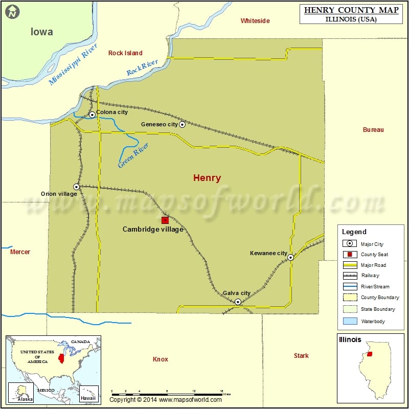
Cities in Henry County
| City | Population | Latitude | Longitude |
|---|---|---|---|
| Alpha village | 671 | 41.19176 | -90.380577 |
| Andover village | 578 | 41.294897 | -90.290735 |
| Annawan town | 878 | 41.394795 | -89.888002 |
| Atkinson town | 972 | 41.415379 | -90.00821 |
| Bishop Hill village | 128 | 41.199461 | -90.11746 |
| Cambridge village | 2160 | 41.297927 | -90.190679 |
| Cleveland village | 188 | 41.503465 | -90.317672 |
| Colona city | 5099 | 41.465542 | -90.34344 |
| Galva city | 2589 | 41.16916 | -90.037248 |
| Geneseo city | 6586 | 41.450028 | -90.153572 |
| Hooppole village | 204 | 41.521564 | -89.91401 |
| Kewanee city | 12916 | 41.239893 | -89.925823 |
| Orion village | 1861 | 41.351429 | -90.376564 |
| Woodhull village | 811 | 41.178573 | -90.322045 |
Golf Courses in Henry County
| Name of Golf Course | Latitude | Longitude |
|---|---|---|
| Baker Park Golf Course-Kewanee | 41.25289 | -89.934614 |
| Champion Executive Golf Course-Orion | 41.387459 | -90.366845 |
| Country View Golf Course-Geneseo | 41.483788 | -90.272109 |
| Geneseo Country Club-Geneseo | 41.47404 | -90.143728 |
| Kewanee Dunes-Kewanee | 41.200181 | -89.96273 |
| Maple Bluff Golf Club-Geneseo | 41.428019 | -90.125061 |
| Oakwood Country Club-Coal Valley | 41.455019 | -90.415438 |
| Valley View Club-Cambridge | 41.296065 | -90.184971 |
 Wall Maps