US States Map > Georgia Map > Georgia Counties > Twiggs County Map, Georgia

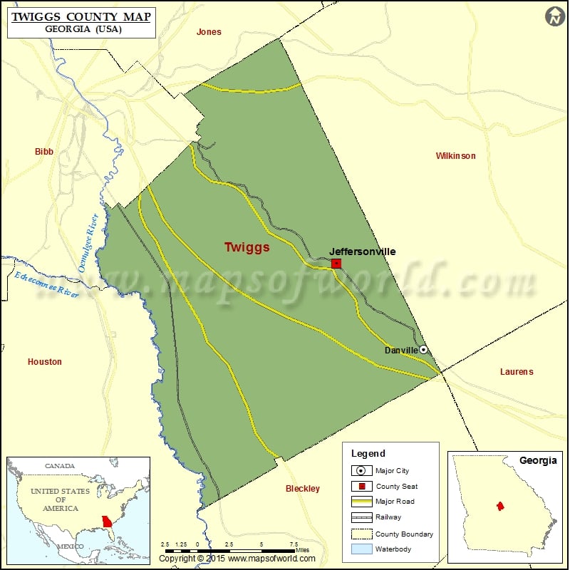
Twiggs County Map, Georgia

by Vishul Malik

Check this Georgia County Map to locate all the state’s counties in Georgia Map. Cities in Twiggs County City Population Latitude Longitude Danville town 238 32.606013 -83.246057 Jeffersonville city 1035 32.686298 -83.343324


Twiggs County Map

Check this Georgia County Map to locate all the state’s counties in Georgia Map.

Cities in Twiggs County

City Population Latitude Longitude
Danville town 238 32.606013 -83.246057
Jeffersonville city 1035 32.686298 -83.343324

Related Maps