1.1K
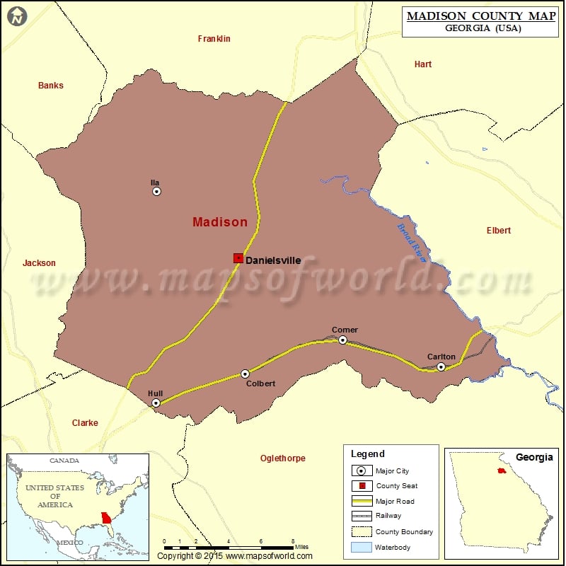
Check this Georgia County Map to locate all the state’s counties in Georgia Map.
Cities in Madison County
| City | Population | Latitude | Longitude |
|---|---|---|---|
| Carlton city | 260 | 34.042654 | -83.038517 |
| Colbert city | 592 | 34.037044 | -83.213849 |
| Comer city | 1126 | 34.062499 | -83.126342 |
| Danielsville city | 560 | 34.123284 | -83.220138 |
| Hull City | 198 | 34.015404 | -83.293947 |
| Ila city | 337 | 34.172919 | -83.292926 |
More Maps of Madison County
- Madison County Map, Nebraska
- Madison County Map, Alabama
- Madison County Map, Florida
- Madison County Map, New York
- Madison County Map, North Carolina
- Madison County Map, Texas
- Madison County Map, Tennessee
Golf Courses in Madison County
| Name of Golf Course | Latitude | Longitude |
|---|---|---|
| Sunrise Golf Club-Colbert | 34.054028 | -83.208811 |
 Wall Maps