2K
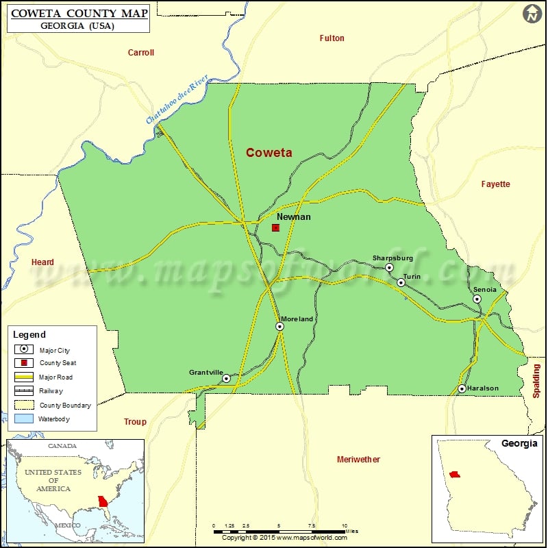
Check this Georgia County Map to locate all the state’s counties in Georgia Map.
Mountain Peaks in Coweta County
| Mountain Peak/Hill | Elevation [Meter] |
|---|---|
| Dunbar Mountain | 258 |
Airports in Coweta County
| Airport Name |
|---|
| Andy Fields Airport |
| Big ‘T’ Airport |
| Dbaks Airport |
| Dresden Airport |
| Jeppesen Ranch Heliport |
| Murphree Airport |
| Murphy’s Landing Airport |
| Newnan Coweta County Airport |
| Newnan Hospital Heliport |
| Panther Creek Airport |
| Piedmont Hospital-Newnan Heliport |
| Rolling Meadows Airfield |
| Two Rocks Airport |
Cities in Coweta County
| City | Population | Latitude | Longitude |
|---|---|---|---|
| East Newnan | 1321 | 33.346213 | -84.776401 |
| Grantville city | 3041 | 33.237759 | -84.828321 |
| Haralson town | 166 | 33.228553 | -84.568822 |
| Moreland town | 399 | 33.28604 | -84.769877 |
| Newnan city | 33039 | 33.377051 | -84.774351 |
| Senoia city | 3307 | 33.311445 | -84.551878 |
| Sharpsburg town | 341 | 33.340705 | -84.648369 |
| Turin town | 274 | 33.326886 | -84.636257 |
Golf Courses in Coweta County
| Name of Golf Course | Latitude | Longitude |
|---|---|---|
| Canongate Golf Course-Sharpsburg | 33.454402 | -84.656504 |
| Canongate on White Oak Golf Course-Newnan | 33.389399 | -84.716038 |
| Coweta Club-Newnan | 33.465156 | -84.698222 |
| Newnan Country Club-Newnan | 33.416581 | -84.777911 |
| Orchard Hills Golf Club-Newnan | 33.332335 | -84.761136 |
| Summer Grove Golf Club-Newnan | 33.374887 | -84.731929 |
 Wall Maps