4K
Check this Florida County Map to locate all the state’s counties in Florida Map.
Mountain Peaks in Walton County
| Mountain Peak/Hill | Elevation [Meter] |
|---|---|
| Big Hill | 53 |
| Blue Mountain | 17 |
| Britton Hill | 105 |
| Crawford Hill | 32 |
| Danley Hill | 93 |
| Dykes Hill | 56 |
| Fox Hill | 84 |
| Hogan Hill | 34 |
| Hunter Hill | 53 |
| Laurel Hill | 54 |
| McKinnon Hill | 56 |
| Ray Hill | 68 |
| Saint Paul Hill | 45 |
| Sandy Mountain | 90 |
| Scrub Hill | 42 |
| Topsail Hill | 3 |
More Maps of Walton County
Airports in Walton County
| Airport Name |
|---|
| Breezy Knoll Airport |
| Cedar Lane Airport |
| Cuchens Airport |
| Defuniak Springs Airport |
| Dugger Field |
| Ellis Agricultural Field |
| Ferguson Airport |
| Joy Farms Airport |
| Mack Bayor Airheart Heliport |
| Melanie’s Airport |
| Pennington Heliport |
| Sacred Heart Hospital of Pensacola Heliport |
| Unicorn Place Airport |
Cities in Walton County
| City | Population | Latitude | Longitude |
|---|---|---|---|
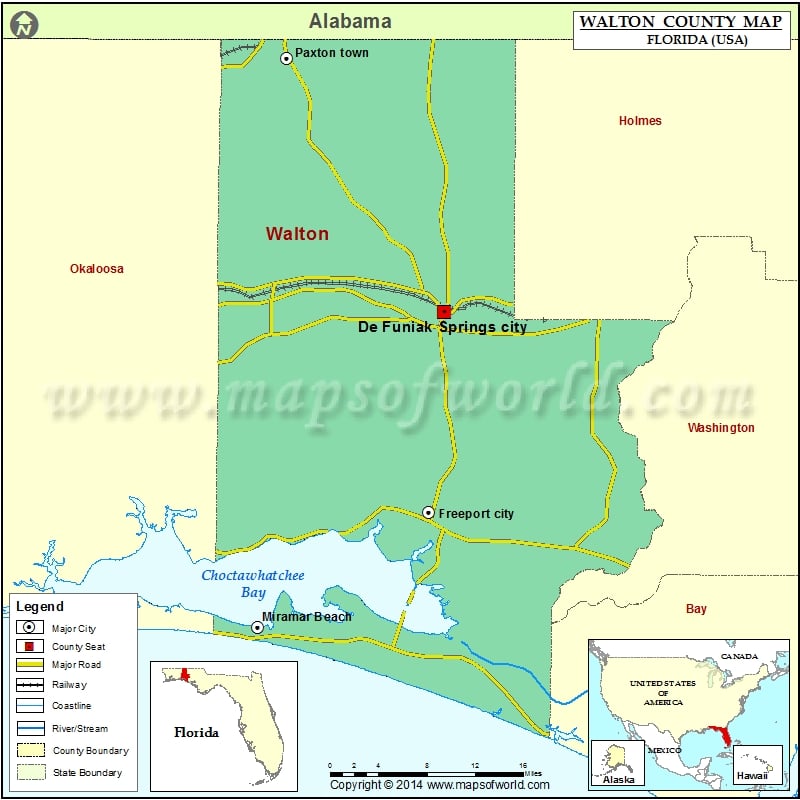
| De Funiak Springs city | 5177 | 30.712243 | -86.120669 |
| Freeport city | 1787 | 30.504438 | -86.139009 |
| Miramar Beach | 6146 | 30.385285 | -86.344068 |
| Paxton town | 644 | 30.975068 | -86.309551 |
Golf Courses in Walton County
| Name of Golf Course | Latitude | Longitude |
|---|---|---|
| Camp Creek Golf Club-Panama City Beach | 30.297107 | -86.040064 |
| DeFuniak Springs Country Club-Defuniak Springs | 30.729001 | -86.140346 |
| Sandestin Golf and Beach Resort-Destin | 30.378457 | -86.32984 |
| Sandy Pines Golf Course-Ponce de Leon | 30.525659 | -85.939132 |
| Santa Rosa Golf & Beach Club-Santa Rosa Beach | 30.360543 | -86.242677 |
| Seascape Resort-Destin | 30.381438 | -86.367411 |
| The Golf Garden of Destin-Destin | 30.385468 | -86.387914 |
| Windswept Dunes Golf Club-Freeport | 30.487117 | -86.031207 |
 Wall Maps