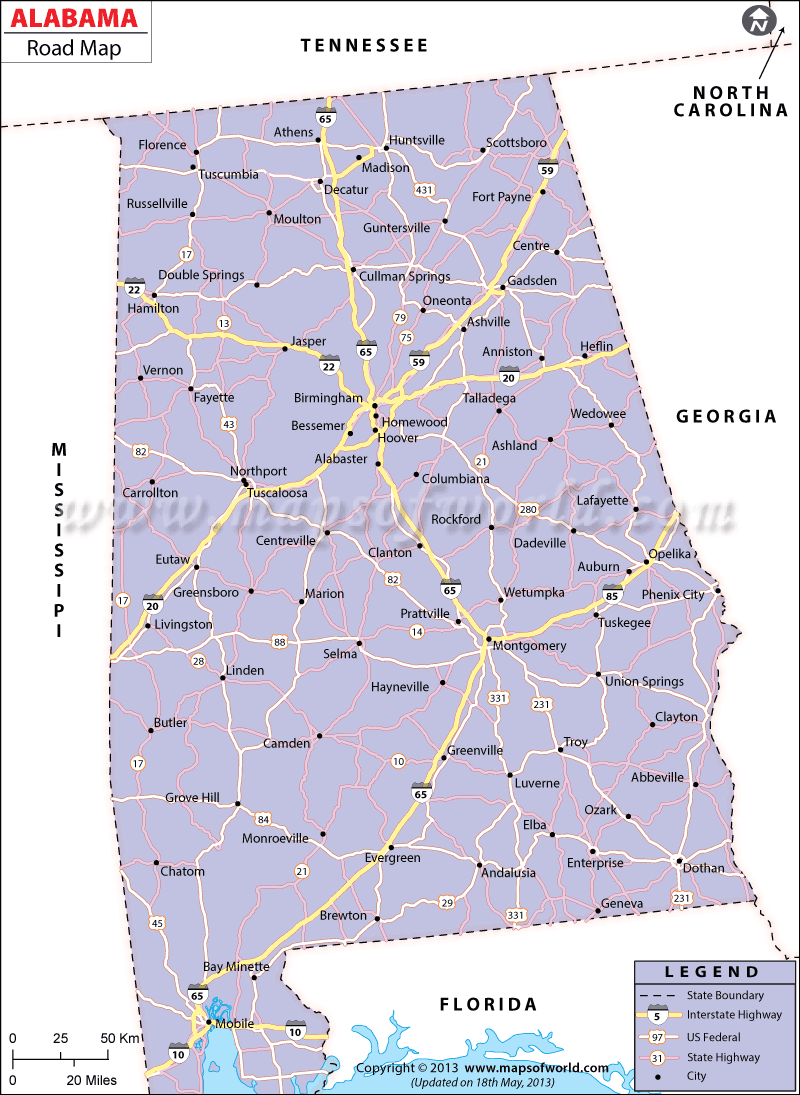
The Alabama Road Map provides detailed information on the several National and State Highways passing through the state. The good roads of Alabama help in intra and inter-state connectivity.
The Interstate Highways of 59, 65, and 85 connect the northern part of the city with the southern end of Alabama. The eastern region of Alabama is accessible from the western part by the Interstate Highways of 10 and 20. This Map offers a clear idea about the transportation facilities of the state. Some of the prominent US Highways running across the state are 331, 72, 278, 11, and 43. The National Highways comfortably connects Alabama with the other states of the United States of America. The important cities of Huntsville, Birmingham, Montgomery, Selma, Dothan, and Mobile are joined by the well-laid roadway system of the state.
Alabama Routes and Highways
US Highways and State Routes: Route 11, Route 29, Route 31, Route 43, Route 45, Route 72, Route 72A, Route 78, Route 80, Route 82, Route 84, Route 98, Route 231, Route 278, Route 280, Route 331, Route 411 and Route 431.
The Alabama Department of Transportation map has devised a comprehensive plan to upgrade the infrastructural amenities of the state. According to the Statewide Transportation Plan (SWTP), the Department of Transportation will build new roads and maintain the old roads for enhancement of conveyance facilities. The Alabama Street Map serves as a useful guide to the tourists and local inhabitants as well.
 Wall Maps