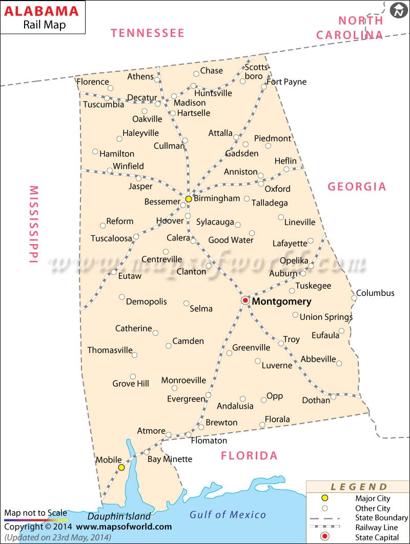
The Alabama State Railroad Map indicates the well-laid railway system of the state that helps in easy communication. The State of Alabama is easily accessible from all parts of the United States of America by railways. The well-developed railway network of Alabama joins the prominent cities of the state. The railway map of Alabama further points out the major cities that cater to the railway services. Athens, Hartselle, Birmingham, Calera, Winfield, Eutaw, Oxford, Opelika, Montgomery,
Troy, Dothan, Brewton, Atmore, and Mobile are some of the prominent cities of the state of Alabama that are connected by railways.
The Alabama Railway Association, a non-profit organization provides railway services to the local inhabitants at cheaper rates. The railway services offered by the organization include short lines and Class I and II categories of railroads of Alabama. The North Alabama Railroad Museum also provides the native population with excellent railway services. A novel step to promote tourism, the North Alabama Railroad Museum offers the tourists an exciting joyride across the state. The railroad connects the southern end of the state with Nashville, St. Louis Railway, and Chattanooga. The Alabama Map of the state provides detailed information on the various rail routes of the state of Alabama of the United States of America.
 Wall Maps