What are the Key Facts of Illinois?

|
State |
Illinois |
|
State Capital |
Springfield |
|
Largest City |
Chicago |
|
Coordinates |
40°N 89°W |
|
Nickname(s) |
“Land of Lincoln”, “Prairie State” |
|
Postal Abbreviation |
IL |
|
Area |
57,914 sq. mi (149,997 sq. km) |
|
Highest Point |
Charles Mound, 1,235 ft (376.4 m) |
|
Number of Counties |
102 |
|
Neighboring States |
Wisconsin, Michigan, Indiana, Indiana, Kentucky |
|
Population |
12,671,821 (2,019) |
|
Date of Entering the Union |
December 3, 1818 |
|
State Anthem |
“Illinois” |
|
Governor |
J. B. Pritzker (Democrats) |
|
Lieutenant Governor |
Juliana Stratton (Democrats) |
|
U.S. Senators |
Dick Durbin (Democrats), Tammy Duckworth (Democrats) |
|
U.S. House Delegation |
13 Democrats, 5 Republicans |
|
GDP (Millions of Dollars) |
865310 |
|
Demonym |
Illinoisan |
|
Time Zones |
UTC-06:00 (Central), Summer (DST) UTC-05:00 (CDT) |
Where is Illinois?
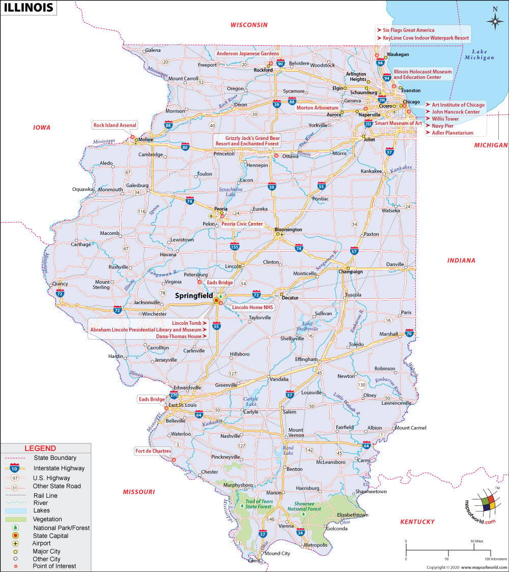
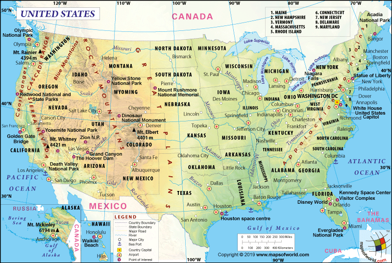
Illinois (the 21st state admitted to the union on December 3, 1818) is located in the Midwestern and Great Lakes Regions of the US. It is a landlocked state surrounded by Iowa and Missouri to the west, Kentucky to the southeast, Indiana to the east, Michigan to the northeast, and Wisconsin to the north.
What is the Geography of Illinois?
Illinois is spread across a total area of 57,914 sq. mi (149,997 sq. km), making it the 25th largest state in terms of the total area. Out of the total area, 55,593 sq. mi (143,969 sq. km) is land area and 2,320 sq. mi (5,981 sq. km) is water area. Water bodies constitute around 4.1% of the total area.
Some of the major rivers in Illinois are Mississippi River, Ohio River, Wabash River, Kaskaskia River, Rock River, Illinois River, Sangamon River, Little Wabash River, Fox River and Embarras River. The major lakes in this state are Carlyle Lake, Rend Lake, Lake Shelbyville, Lake Michigan, Lake Michigan-Huron, Fox Chain O’Lakes, Crab Orchard Lake, Clinton Lake, Lake Springfield and Horseshoe Lake. This state is bordered by Wabash and Ohio Rivers on the southeast and south and the Mississippi River on the west.
Illinois is 390 mi (628 km) long and 210 mi (338 km) wide. The mean elevation of the state is 600 ft (183 m) above sea level. While Charles Mound is the highest elevation point at 1,235 ft (376 m) above sea level, the Mississippi River is the lowest elevation point at 279 ft (85 m) above sea level.
Some of the significant mountains in Illinois are Charles Mound, Benton mound, High Point, Mount Sumner, Hudson Mound, Squirrel Grove Mound, Scales Mound, Simmons Mound, Horseshoe Mound, Williams Hill and Gold Hill.
The three main regions in this state are the Central Plains, the Shawnee Hills, and the Gulf Coastal Plain.
The most dominant landscape in the state is the Central Plains, occupying around 90% of Illinois. The Central Plains are gently rolling fertile plains that were leveled and carved during the Ice Age by glaciers. It starts from Lake Michigan in the west and south and stretches almost throughout Illinois. The Central Plains are divided into three sections: the Great Lakes Plain, the Driftless Plains, and the Till Plains.
The Great Lakes Plain is a flat stretch of land that is spread along Lake Michigan, developing some small hills to the north as well as west of Chicago. The Driftless Plains are located in the northwestern parts of the state and usually have the highest elevations (consisting of large hills and valleys). The highest elevation point of Illinois is also located in the Driftless Plains.
The Till Plains occupy the most significant part of the Central Plains, contributing Illinois’ share of the Corn Belt. The fertile soil type present here helps the state produce large quantities of corn, helping Illinois become one of the largest producing states of the United States. That is why this state has become one of the leading agricultural states, earning its nickname “The Prairie State” or the “Garden Spot of the Nation”.
The second most important landscape in Illinois is the Shawnee Hills, which is located to the south of the Central Plains. This plain in the south of Illinois is a small strip of land that is around 70 miles (113 km) long and 5-40 miles (8-64 km) wide. This landscape is characterized by higher elevations ranging from 300 ft (91 m) to 1,065 ft (325 m). It consists of valleys, woodland, and rivers.
The third most prominent landscape in Illinois is the Gulf Coastal Plain. The Gulf Coastal Plain’s northern reach in the extreme southern tip of Illinois stretches from the Gulf of Mexico to the north. This plain is located within the Ohio River on the east and the Mississippi River on the west. It has a significant resemblance to the Nile Delta, thereby earning it the name “Egypt”. The Gulf Coastal Plain, to the south of the Shawnee Hills, tends towards being hilly but flattens significantly towards the Illinois-Kentucky border.
What is the Climate of Illinois?
Illinois has a widely varying climate due to mid-continental placement and its length of 390 mi (628 km). Most parts of the state have a humid continental climate, characterized by mild cold-to-cold winters along with warm and humid summers.
Frequent short fluctuations are witnessed in the direction of wind, temperature, humidity, and cloudiness. The temperatures during spring and fall (also called autumn) are very pleasant. The average monthly temperature remains within a high of 87.1 °F (30.6 °C) to a low of 9.8 °F (-12.3 °C).
A humid subtropical climate is found in the southernmost part of Illinois (including the places such as Carbondale southward, the eastern suburbs of St. Louis). The average yearly rainfall is higher (receives around 48 inches or 1,220 mm) in the southern tip of the state than the northern portion (around 35 inches or 890 mm). The places such as Chicago receive an average level of snowfall, exceeding 38 inches or 0.97 m. However, the southern part of the state receives less than 14 inches or 0.36 m of snowfall.
The extent of thunderstorm on-an-average is around fifty in a year. Tornadoes hit the place every year. Reports say that on-an-average 54 tornadoes rattle the state every year.
What is the Economy of Illinois?
Illinois is one of the largest economies in the US. Its total Gross Domestic Product (GDP) increased from US$646,366.6 to US$865,310.4 during 2008-2018. The per capita personal income also grew from US$43,267 to US$56,839 during the same period. The median household income also increased from US$53,254 in 2008 to US$70,145 in 2018. The unemployment rate in the last decade was at its peak of 12.2% in January 2010. It came down to 3.4% in November 2019.
This state is said to be a microcosm of the US economy because of the diversified economic structure. The main strengths of the economy are manufacturing, agriculture, government, transportation, mining, finance, technology, services, tourism, among others.
The total value of exports and imports of the state was $65,491,406,440 and $157,057,657,368 respectively in 2018, making them the sixth-largest exporter state and third-largest importer state of the country. Illinois had a trade deficit of around -$91,566,250,928, giving them the 48th trade balance rank in the US.
The major export items are Industrial Machinery, Electrical Machinery, Motor Vehicles and Parts, Precision Instruments, Oil and Mineral Fuels, Plastics, Pharmaceuticals, Iron and Steel Articles, Oil Seeds, Chemical Products, etc. The major import items are Electrical Machinery, Oil and Mineral Fuels, Industrial Machinery, Aircraft, Pharmaceuticals, Plastics, Beverages, Precision Instruments, Motor Vehicles and Parts, etc.
Over 12.6% of the population or 1,569,753 people out of a total population of 12,503,720 live below the poverty line in Illinois.
What is the Transportation System of Illinois?
Illinois has an extensive network of the roadway system, including interstate highways and state highways. Some of the important interstate highways are I-24, I-39, I-41, I-55, I-57, I-64, I-70, I-72, I-74, I-80, I-88, I-90, and I-94. Some of the important state routes in Illinois are IL 1 to IL 186, IL 190, IL 192, IL 194, IL 199, IL 203, IL 213, IL 226, IL 242, IL 250, IL 251, IL 255, IL 267, IL 316, IL 336, IL 351, IL 390, IL 394, and IL 594.
The major airports in Illinois are Chicago O’Hare International Airport (in Chicago), Chicago Midway International Airport (in Chicago), Quad City International Airport (in Moline), General Wayne A. Downing Peoria International Airport (in Peoria), Central Illinois Regional Airport at Bloomington-Normal (in Bloomington), Chicago Rockford International Airport (in Rockford), to name a few.
Why Illinois is called “The Prairie State”?
Illinois was once entirely covered with prairie grasses, the most endangered ecosystems on earth. To pay homage to these endangered prairie grasses, Illinois was given a nickname: The Prairie State. The mention of this nickname can be found as far back as 1842. Big bluestem grass (Andropogon gerardii) is the official state prairie grass of Illinois.
The other nicknames of the state are “Land of Lincoln”, “The Corn State”, “The Garden of the West”,” The Sucker State, Egypt”, “Inland Empire” and “Rainy State”.
What are the Popular Tourist Attractions in Illinois?
Willis Tower Skydeck, Millennium Park and Cloud Gate, Magnificent Mile in Chicago, Abraham Lincoln Presidential Library and Museum, Navy Pier, Lincoln Park, Anderson Japanese Gardens, Starved Rock State Park, Cahokia Mounds State Historic Site, Art Institute of Chicago
Facts About Illinois
Illinois is the 21st state of the United States. Illinois achieved the status of a state on December 3, 1818. The capital city of Illinois is Springfield and the biggest city of the state is Chicago. The demonym of Illinois is Illinoisan. The state covers a total area of 57,914 sq miles, making it the 25th biggest state in the country. Get interesting Illinois facts and trivia to enhance your knowledge.
1) Illinois is nicknamed “The Prairie State”.
2) The state of Illinois comprises 102 counties and its capital is Springfield.
3) The oldest skyscraper was constructed in Chicago.
4) Prior to Springfield, Vandalia and Kaskaskia also served as the capital of the state.
5) Galena houses the residence of Ulysses S. Grant, the 18th President of the United States.
6) Tampico is the hometown of Ronald Wilson Reagan, the 40th President of the country.
7) The official motto is “Mile After Magnificent Mile”.
8) The tallest point in the state is the Charles Mound. The altitude is 1,235 feet.
9) Saint Patrick’s Day is an important festival in the state.
10) The official flower is the Native Violet.
11) The official anthem is “Illinois”.
12) The official mammal is the “White-Tailed Deer”.
13) The official bird is the Northern Cardinal.
14) The important industries include processed food, machinery and equipment, fishing, publishing, and chemicals.
15) The oldest neighborhood in the state is Peoria.
16) The biggest artificial lake in the state is situated in Carlyle.
17) The official tree is the White Oak.
18) The official dance is the square dance.
19) The state of IL is famous for its diverse climatic conditions.
20) The official fish is the Bluegill.
Related Links:


