1.9K
- Continent And Regions - Oceania Map
- Other Tonga Maps - Tonga Map, Where is Tonga, Tonga Blank Map, Tonga Cities Map, Tonga Flag
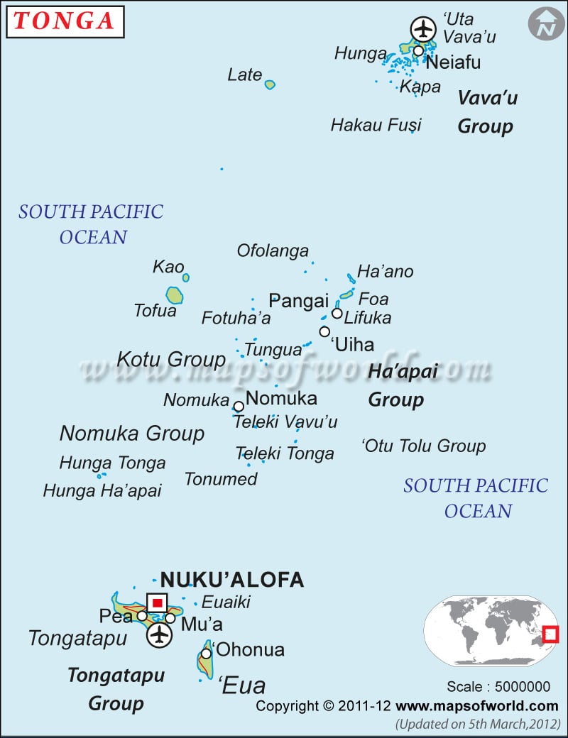
Political map of Tonga illustrates the surrounding countries with international borders, 3 island groups boundaries with their capitals and the national capital.
previous post

 Tonga Facts