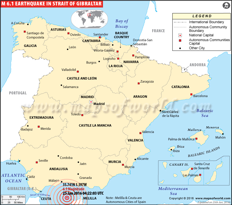
Gibraltar Earthquake Map
M6.1 Earthquake hits Gibraltar- January 25, 2016

| Description :Map showing the epicentre of M6.1 earthquake in Gibraltar on Jan 25, 2016 04:22:03 UTC. |
| Disclaimer |
*We specifically create maps that have a magnitude of 6 or more on the Richter Scale.
Preliminary Earthquake Report
| Preliminary Earthquake Report | Gibraltar Earthquake |
|---|---|
| Magnitude | 6.1 |
| Date-Time | |
| 25 Jan 2016 04:22:03 UTC | |
| 25 Jan 2016 04:22:03 near epicenter | |
| 25 Jan 2016 08:22:03 standard time in your timezone | |
| Location | 35.741N 3.597W |
| Depth | 10 km |
| Distances | |
| 62 km (38 mi) NNE of Al Hoceima, Morocco | |
| 64 km (39 mi) NNE of Tirhanimine, Morocco | |
| 69 km (42 mi) NNE of Imzourene, Morocco | |
| 7 km (47 mi) NW of Melilla, Spain | |
| 164 km (101 mi) ESE of Gibraltar, Gibraltar | |
| Location Uncertainty | Horizontal: 7.1 km; Vertical 1.8 km |
| Parameters | Nph = 94; Dmin = 248.2 km; Rmss = 1.36 seconds; Gp = 54° |
| USGS Event ID | us 10004gy9 |
