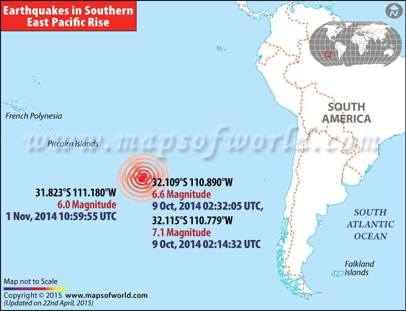
Earthquake in Southern East Pacific Rise
History of Earthquakes in Southern East Pacific Rise

| Description :Map showing location of various historic earthquakes which occurred in Southeastern Pacific Rise |
| Disclaimer |
*We specifically create maps that have a magnitude of 6 or more on the Richter Scale.
Strong 7.1 & 6.6 magnitude Earthquake shakes southeastern Pacific Rise
A powerful earthquake with a magnitude of 7.1 & 6.6 hit the southeastern Pacific, which is about 570 kilometres south of the Easter Island in Chile, on Wednesday, October 9, according to the US Geological Survey. The quake was 10 kilometres deep and has not caused any risk of tsunami, the Pacific Tsunami Warning Center, located in Hawaii said. Chile, which is situated in the Ring of Fire, a region of Pacific Ocean basin, is one of the most seismically active nations on earth.
WBASH091014
