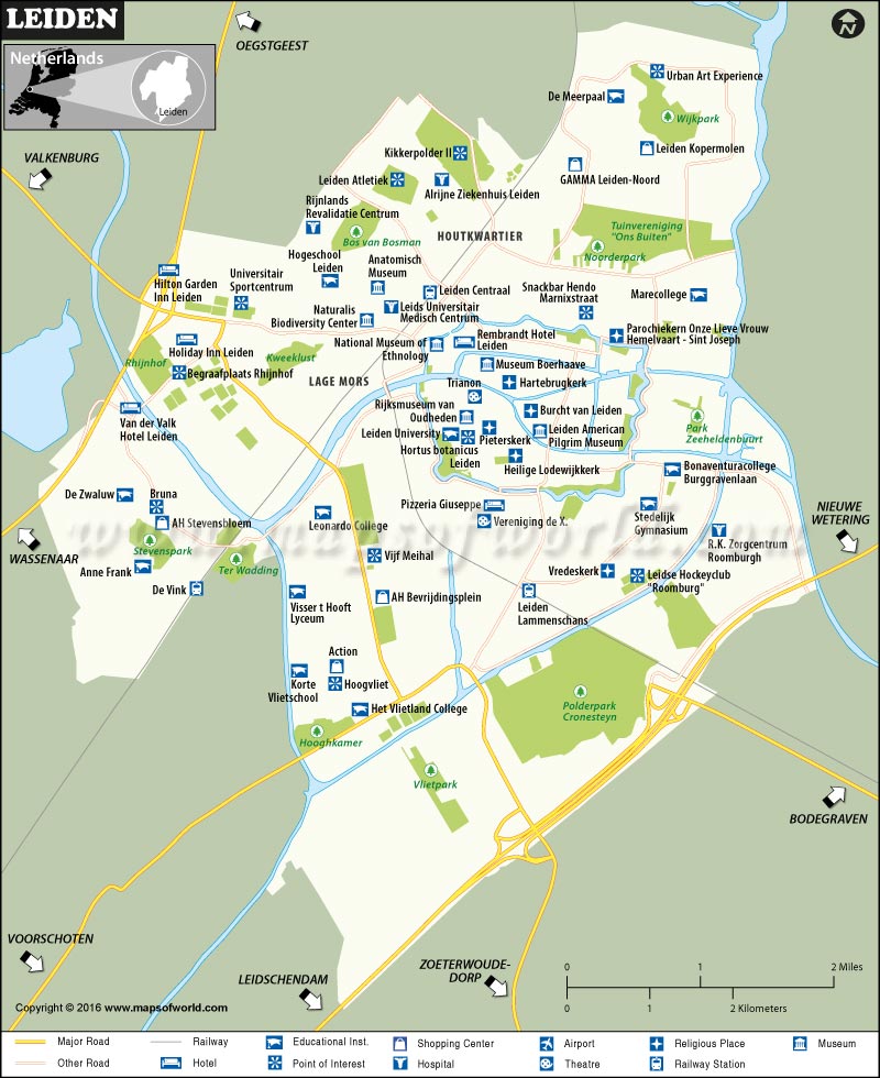
Leiden is a city in the province of South Holland in the Netherlands. The city is located on the Oude Rijn and is home to over 206,000 inhabitants in its metro area.
How to Reach Leiden
The city lies about 20 minutes from Schiphol Airport (AMS), the busiest airport in the Netherlands.
Rail is the most convenient option to reach Leiden. Railway stations in the city are: Leiden Centraal, Leiden Lammenschans, and De Vink.
The E19 connects the city with The Hague (12 miles) and Amsterdam (25 miles).
Best Time to Visit Leiden
Spring and Fall are the best seasons to make the most of Leiden’s delights. Extravagant flower bloom in spring and cultural festivals in Fall are the main reasons to visit Leiden.
Things to Do in Leiden
A city of the Pilgrim Fathers, Leiden has a rich cultural heritage. Its 17th-century town center is the second largest in the Netherlands. The city is also renowned for being the birthplace of Rembrandt, one of the most prolific painters of his time. A cache of national museums—Naturalis Biodiversity Center, Museum Boerhaave, and Molen de Valk Windmill Museum—along its picturesque canals and all within walking distance of each other, are another draw for tourists.
The Pieterskerk, Burcht van Leiden (Leiden’s castle), and Hortus Botanicus Leiden are the most popular attractions in Leiden. Make sure to visit Kagerplassen (the Kaag Lakes), an ideal destination for watersports and camping.
Facts about Leiden
- Founded in 1575, Leiden University – where Einstein worked as a professor – is the oldest university in the country.
- Leiden is the place where the Pilgrims departed to the New World on Mayflower ship in the early 17th century.
