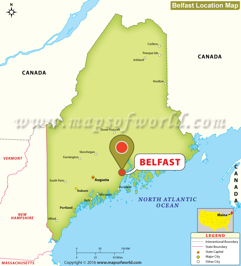
| About Belfast , Maine | |
|---|---|
| Location: | Belfast |
| Latitude: | 44.26N |
| Longitude: | 69.01W |
Belfast, Maine
The city of Belfast is located in Maine's Waldo County. Covering an area of 38.37 square miles, Belfast is home to 6,668 people as per the 2010 census. The Passagassawakeag River runs through the city. The temperatures ranges from very hot to cold. While summer are hot and humid, winters are cold and dry.
The history of the city dates back to many centuries. Before the arrival of the Europeans, the region was a territory of the Penobscot tribe of Abenaki Indians. The city, which was renamed after the Northern Ireland city of Belfast, saw its first settlement in 1770. In 1773, Belfast was incorporated as a town. It became the county seat of the Waldo County in 1827. In the year 1853, it was incorporated as a city in the state of Maine.
Belfast boasts of many attractive locations some of which are: Perry's Nut House, Front Street Shipyard, Belfast Free Library, Belfast Historical Society & Museum, and Belfast City Park to name a few.
MOW.PB.21.12.2016
|
Last Updated on : December 22, 2016


