logo


Equatorial Guinea Latitude and Longitude Map

Equatorial Guinea's latitude and longitude is 3° 45' N and 8° 48' E. Below is the map of Equatorial Guinea showing major towns, roads, airports with latitudes and longitudes plotted on it.
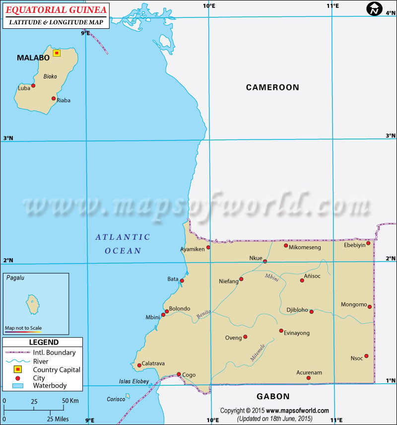
Equatorial Guinea Latitude and Longitude Map
Cameroon Latitude and Longitude Map Gabon Latitude and Longitude Map
Description : Find Equatorial Guinea latitude and longitude map showing comprehensive details including cities, roads, towns, airports and much more. Disclaimer
×

Disclaimer  :  All efforts have been made to make this image accurate. However MapSherpa, Inc, its directors and employees do not own any responsibility for the correctness or authenticity of the same.


Search For Latitude & Longitude Map

By Country

Or

Latitude

Longitude

Or

Area

* Put South & West values with minus ( - ) sign.


Equatorial Guinea , which lies on the western side of the continent of Africa, occupies the latitude and longitude of 3º45 N and 8º48 E respectively.

The latitude and longitude positions of Equatorial Guinea makes it lie between Cameroon and Gabon. Equatorial Guinea's latitude and longitude gives it a total a land area of 28,050 sq km. The capital city of Equatorial Guinea, Malabo , occupies the latitude and longitude of 03°45N and 08°50E respectively.

The latitude and longitude attributes of Equatorial Guinea gives it a tropical kind of climate wherein there are alternate wet and dry seasons. When one place experiences the wet season another place on the same country experiences the reverse climate. The average temperature of Equatorial Guinea, however, remains around 27°C.


Latitude and Longitude of Equatorial Guinea

LocationsLatitudeLongitude
Fernando Poo/Bioko03°30'N08°40'E
Malabo/Rey Malabo03°45'N08°50'E
Mbini/Rio Muni01°30'N10°0'E
Rey Malabo 03°45'N08°50'E
Rio Muni01°30'N10°0'E
Santa Isabel/Rey Malabo 03°45'N8°50'W

Last Updated on: November 13th, 2017