logo


Benin Latitude and Longitude Map

Benin's latitude and longitude is 9° 30' N and 2° 15' E . Below is the map of Benin showing major towns, roads, airports with latitudes and longitudes plotted on it.
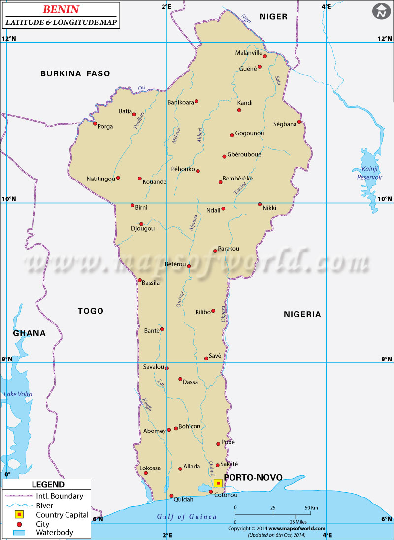
Benin Latitude and Longitude Map Burkina Faso Lat Long Niger Lat Long Nigeria Lat Long Ghana Lat Long Togo Lat Long
Description : Find Benin latitude and longitude map showing comprehensive details including cities, roads, towns, airports and much more. Disclaimer
×

Disclaimer  :  All efforts have been made to make this image accurate. However MapSherpa, Inc, its directors and employees do not own any responsibility for the correctness or authenticity of the same.


Search For Latitude & Longitude Map

By Country

Or

Latitude

Longitude

Or

Area

* Put South & West values with minus ( - ) sign.


The latitude and longitude of Benin is 9° 30'North of the equator and 2° 15 East of Greenwich. The country of Benin which falls within the continent of Africa is a part of the northern hemisphere.
The latitude and longitude of the capital of Benin, Porto-Novo, is 6° 29 North and 2° 37 East. The latitude of Benin is a clear proof of its closeness to the equator or the great circle. This can be held partly responsible for the hot and humid climate of the country. The longitudes and latitudes within Benin cover the total area of 112,620 square kilometer. The main longitude of Benin signifies the UTC+1 time zone of Benin which means that the time is one hour more than the Greenwich Mean Time. The standard time zone of Benin is 6 hours more than the standard time of Washington DC.

Latitude and Longitude of Belize

LocationLatitudeLongitude
Abomey07°10'N02°05'E
Bembereke10°11'N02°43'E
Cotongou06°20'N02°25'E
Kandi11°07'N02°55'E
Natitingou10°20'N01°26'E
Parakou09°25'N02°40'E
Porto-Novo06°23'N02°42'E
Savalou7°57'N1°58'E

Last Updated on: November 9th, 2017