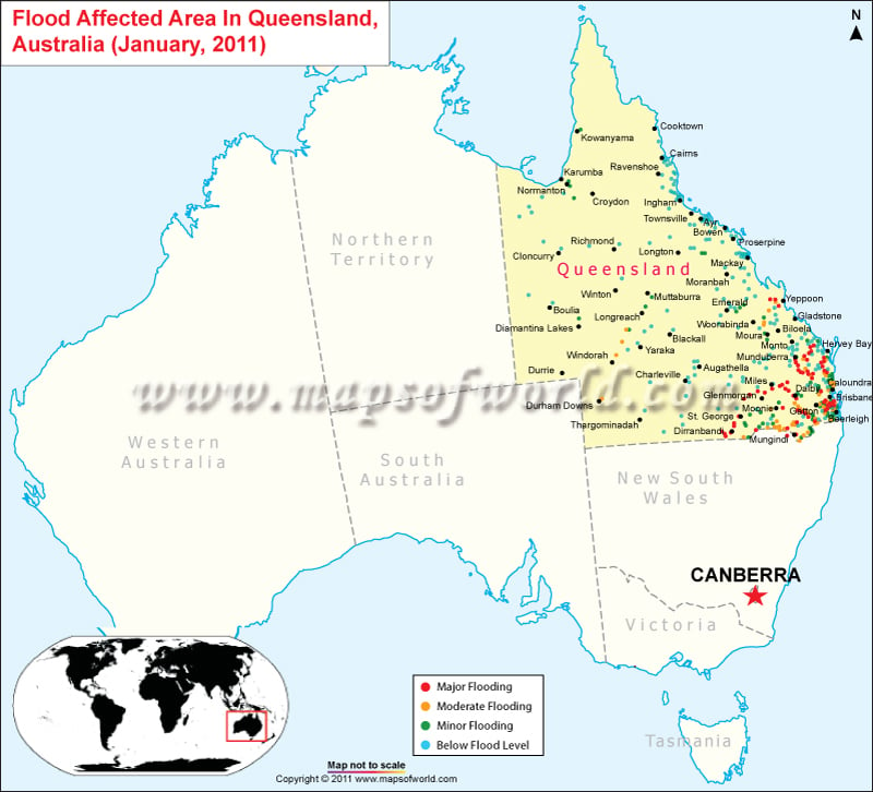
Massive rains and flood caused major devastation in Australia’s largest cities – Queensland and Brisbane in the first week of January, 2011. The flood in Australia killed about 10 people and almost 100 went missing. Australian flood has affected almost 200,000 people. The water was still pushing its way downstream, flooding river systems as it moved towards the coast on 11-Jan-2011.
Thousands have been evacuated from communities in the water’s predicted path, and officials closed roads and highways to some areas at high risk of being inundated. Residents in low-lying regions of the state capital of Brisbane were urged to sandbag their homes and later told to move to higher ground. The Brisbane River is still rising, with water levels are expected to peak on 13-Jan-2011. Meteorologists expect the flooding to continue for weeks.
The sudden change of weather is a shock for Australian residents who were more used to water shortages brought on by drought. The January, 2011 floods are feared to be worse than that of 1974, when thousands of homes were swamped, and about 14 people died.
